Two Arches, Gaviota Coast

I hiked to the two arches amid the rocky crags of the Gaviota Coast. Along the way on the ridgeline leading to the arches, there is a mountaintop grassy flat shaded by a few gnarled, lichen covered oak trees that are tucked up against a sandstone outcrop. The wind sucks over the narrow rock-studded ridge with a degree of force and regularity that is plainly revealed in the slanted angle at which the oak trees grow. And the leafless branches stripped bare on the windward side of some plants.

Stepping through the few oak trees that cover the shaded flat or climbing up a few feet of the outcrop reveals a sweeping toes-over-the-edge view of the Pacific Ocean a thousand feet or so below. In late afternoon the sun’s glare reflects off the ocean like a mirror and blasts the south facing mountain slopes with especial intensity.

The wind worn sandstone around the flat is ragged and sharp-edged like volcanic scoria, and pockmarked with caves and cavities scoured out of the gritty rock by persistently gusty weather. About a half mile east along the same ridge, the constantly blustery conditions have created two arches by eroding gaping holes through the ribs and knobs of bedrock protruding from the mountainside.

The ridge top flat overlooking the ocean.

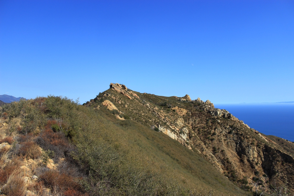
Looking east from the oak tree flat in the previous photo, along the same ridgeline, and toward the arches.
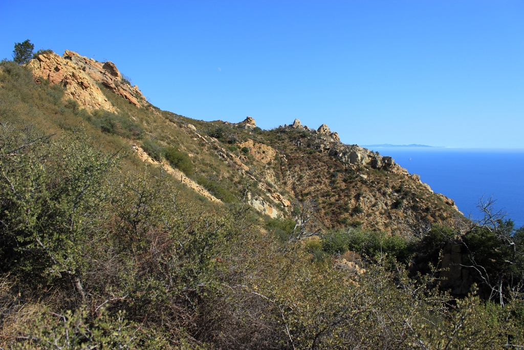
Getting closer.

Top of the ridge just above the arches.

Santa Rosa Island

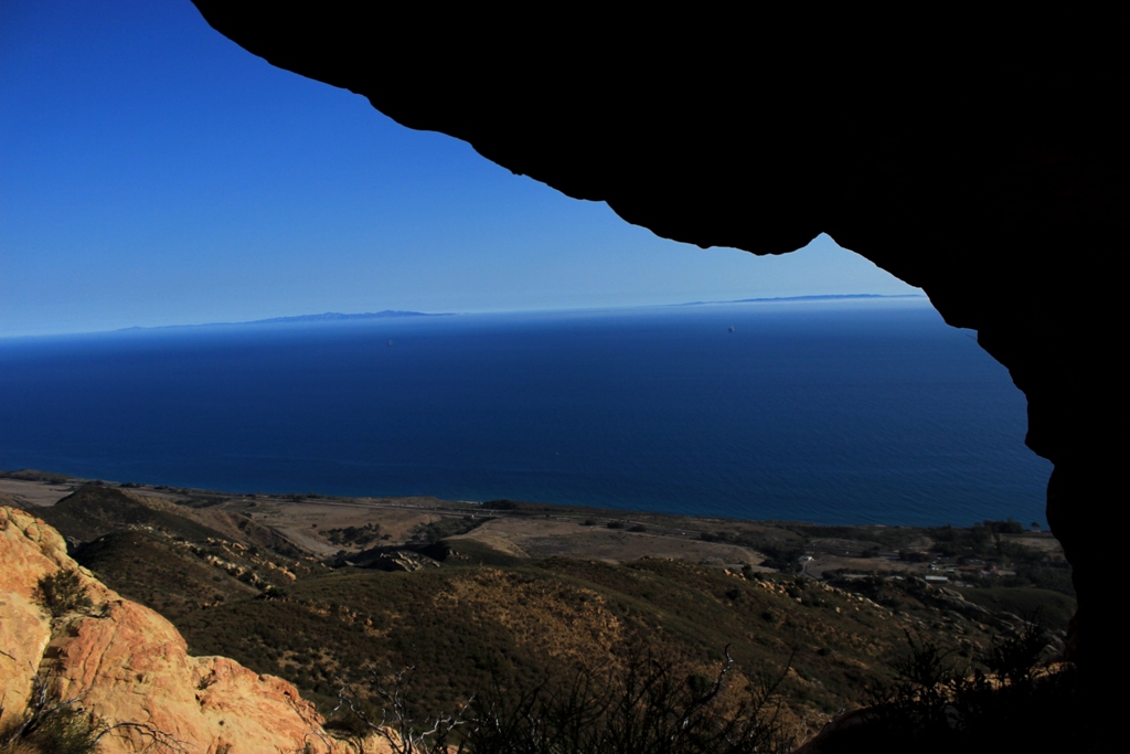
Looking southeast over the Gaviota Coast and toward Santa Barbara.

The smaller arch.

The bigger arch.

Related Post:

Twin Arches, Gaviota Crags

Posted in Santa Barbara County | Tagged , , , , , , , , , , , | 3 Comments

Sawtooth Ridge, California

Sawtooth Ridge in the Eastern Sierra Nevada Mountains.

Sawtooth Ridge lies in California’s Hoover Wilderness within the Humboldt-Toiyabe National Forest. The ridge comprises a portion of the northeast boundary of Yosemite National Park.

Some of its notable features include, from left to right, Matterhorn Peak (12,281), Cleaver Peak (11,850), Blacksmith Peak (11,850) and Eocene Peak (11,555).

Posted in California | Tagged , , , , , , , , | 2 Comments

East Walker River at Sunrise

sunrise in the valley

A view of the East Walker River this morning on the edge of the Eastern Sierra in California.

Posted in California | Tagged , , , , , , , , | 3 Comments

Holly-leaved Cherries

Holly-leaved cherries (Prunus ilicifolia), seen here in the process of ripening, are a wild grown food that can be foraged in the local mountains.

“Prunus ilicifolia is the most common wild cherry in coastal California south of San Francisco Bay, and it was used as food by every group in whose territory it occurs.”

—Jan Timbrook Chumash Ethnobotany: Plant Knowledge Among the Chumash People of Southern California

Holly-leaved cherries, called ‘akhtayukhash in Barbareno Chumash, are fruiting right now. The fruit, which grows as a thin layer of flesh covering a hard marbled-sized seed pod, is edible right off the plant. The pulp is not much thicker than the skin and offers little more than a taste, but it is juicy and sweet tasting.

Though the pulp is edible, the kernel within the fruit pit was the most valued part of the plant for the Chumash Indians. The seed pods were cracked and the kernels collected, which could then when dried be stored for as long as necessary until they were needed.

The kernels, however, contain hydrocyanic acid and are poisonous. Before eating them they must be properly prepared to remove the poison, as well as their bitter taste. The preparation process involves leaching the poison from the kernels using fresh water.

After the kernels were leached of poison, they were cooked for several hours by boiling until they became soft, then mashed, rolled into balls and coated in pinole flour made from juniper or grass seeds. “The Chumash consultants,” Timbrook notes, “all agreed that it was a good-tasting and prized food.” The small cakes were eaten with roasted meat and were also a featured food in ceremonial events.

A cherry pit without the skin showing some of the yellow fruit pulp still clinging to the seed pod.

Posted in Reference | Tagged , , , , , , , , , | 2 Comments

Salmon River, Idaho

The Salmon River, which is the second largest tributary of the Snake River, is also known as The River of No Return. ©Clint Elliott

Map

“The Salmon River Canyon is one of the deepest gorges in North America, deeper even than the famous Grand Canyon of the Colorado in Arizona. But in contrast to the Grand Canyon, the Salmon River Canyon is not noted for sheer walls and towering heights, but instead for the variety of landscapes visible from the river; wooded ridges rising to the sky, huge eroded monuments and bluffs and slides, picturesque castles and towers, and solitary crags. The United States Congress designated the Frank Church-River of No Return Wilderness in 1980 and it now encompasses a total of 2,366,757 acres.

The name of this Wilderness has two roots. The Main Salmon River was called “The River of No Return” back in the early days when boats could navigate down the river, but could not get back up through the fast water and numerous rapids. The romantic name lives on today even though jet boats can navigate upstream. Second, the name Frank Church that was attached to this Wilderness in 1984, after it’s designation, is a memorial to honor a man who did so much to help preserve this wild central core of Idaho.”

United States Forest Service

Posted in Idaho | Tagged , , , , , , , , , | 1 Comment