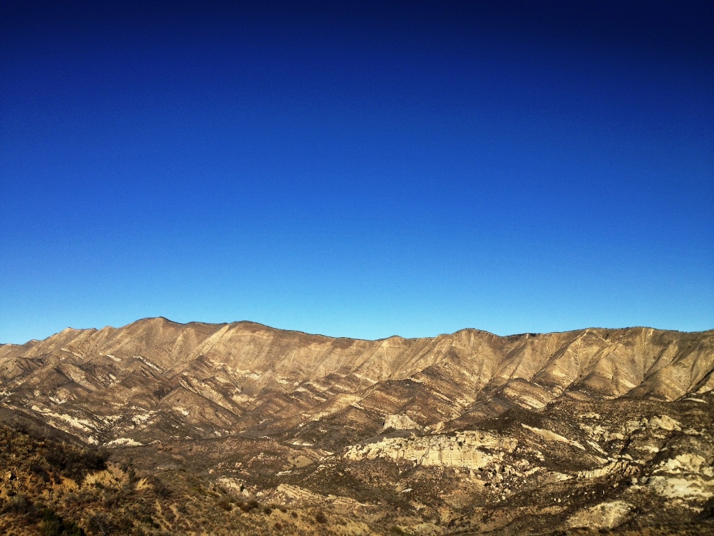
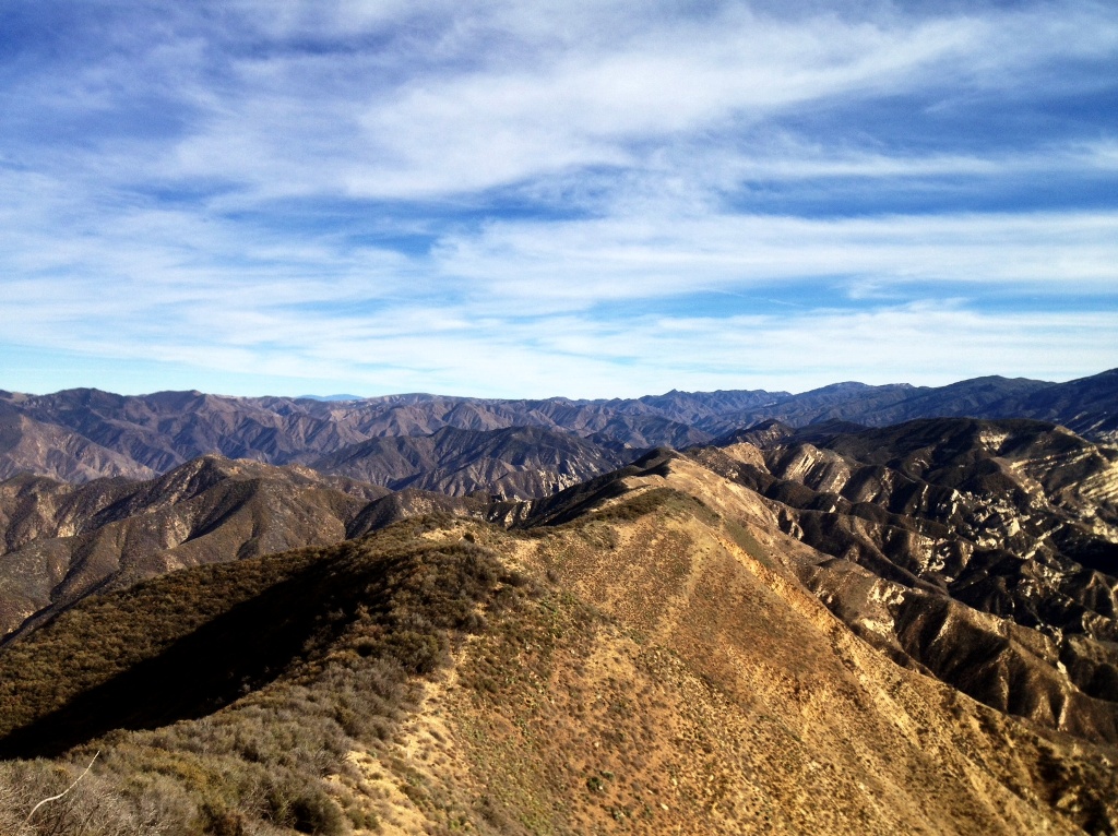
Hurricane Deck, the prominent ridge defining the skyline.
There is no trace of water on Hurricane Deck, no trees and no campgrounds. It’s a 20 mile long ridgeline with south facing cliffs and steep grassy slopes on one side and a dense cover of chaparral on the other. It can be hot even in winter and deadly, broiling hot in summer.
Something sort of like a trail runs across the top of the ridge, but it’s neglected and unmaintained, brushy and ill-defined. In some sections it’s downright dangerous as a makeshift trail skirts the cliffs with only inches of space to walk, a precipice on one side and a wall of wiry chaparral poking at you from the other.
The clifftop is shaley and loose, with piles of small domino-like flat, rectangular pieces of interlaced stone covered in thin layers of dirt. Step near the cliff edge and the shale dominoes slide apart and the earth seems to disintegrate underfoot. One misstep could easily send a hiker over the edge and they wouldn’t stop tumbling for several hundred feet.
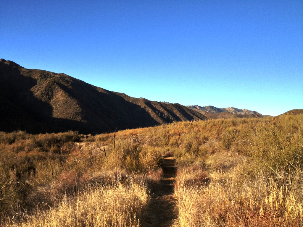
 Lost Valley Trail
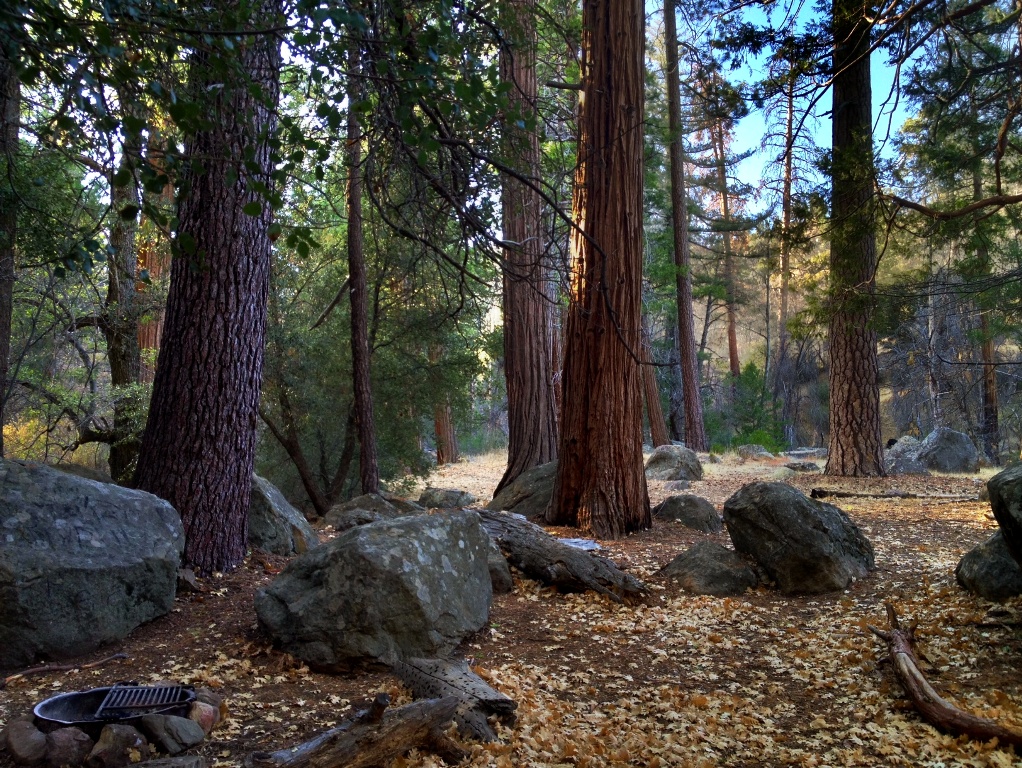
 Twin Oaks Camp along Lost Valley Trail.
Crossing the top of middle Hurricane Deck recently, I was able to link a combination of old trail cut through the brush, current animal paths and thin use trail left by the occasional intrepid backcountry hiker. I only had to crawl under or through the brush in three areas, but only for a few feet at a time, which wasn’t bad. I had expected worse.
Never having crossed this middle section of the ridge I wasn’t sure how passable the route would be, and was all the while concerned I was going to run into impenetrable chaparral half way into my day, some 12 to 14 miles from the trailhead, and find myself stuck with only fleeting hours of short winter daylight. Sunset comes fast this time of year. I didn’t want to be fighting my way through a bramble of brush at half a mile an hour or less as the sun began setting.
At a certain point on such a hike there is no going back, and you commit to the planned task and just hope you make it through before it gets dark. I’m not the type to ask people for current conditions. Life’s a gamble. And that’s the beauty of it.
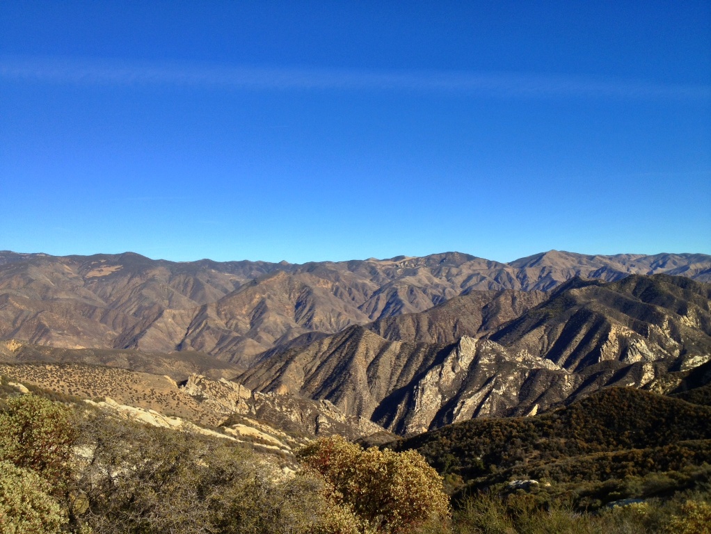
 Looking over the Sisquoc River watershed as seen from the junction of Lost Valley Trail and Hurricane Deck Trail.
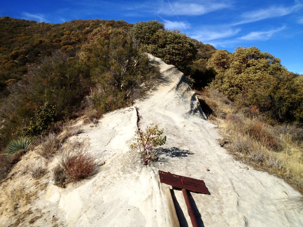
 The junction of Lost Valley Trail and Hurricane Deck.
 Looking back, eastward, over where I’d come from along the top of Hurricane Deck.
There are no rock formations of interest, no rolling grassy potreros or any other sort of notable features on top of middle Hurricane Deck. Perhaps the most remarkable feature are the views of Manzana Creek watershed on one side and the Sisquoc River drainage on the other.
I’ve heard of Europeans visiting the Santa Barbara area who’ve allotted time in their itinerary to hike Hurricane Deck. I wonder if those tourists made this particular geographical feature of the San Rafael Wilderness a destination based solely on the romantic, adventurous name it was bestowed with, because I can’t imagine what else might have led them to want to spend what little time they had on vacation hiking it. It had to be the lure of the name.
I’ve heard of other people of local origin that set out to hike the trail for the first time by trying to do it at night under a full moon. I don’t know how it works elsewhere, but around the southern Los Padres National Forest it’s not wise to assume a trail is easily passable just because it’s listed on a map. In fact, what’s labeled on a map as a trail may not even exist in any other manner but in old cut branches long buried in a thicket of overgrown chaparral.
What if Hurricane Deck was renamed using the ever expansive Big Book of Tiresome Cliches? What if it was instead named all too accurately the sunbaked, wind-swept, dry as a bone, God forsaken ridge? It certainly would not attract as much attention or foot traffic as it does, which is little as it is.
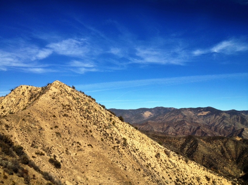
 A section of Hurricane Deck. The trail, or a trail, runs up the edge of the steep ridgeline to the conical apex and then down the saddle on the left.
 Potrero Canyon Trail showing Hurricane Deck looming in the upper left-hand corner of the frame.
Related Post:
Potrero Canyon, Hurricane Deck, Manzana Creek 20 Mile Day Hike

 Afternoon reflections on a deep pool, which would be a lot deeper, as the mineral stain on the rock shows, were it not for the current droughty conditions.
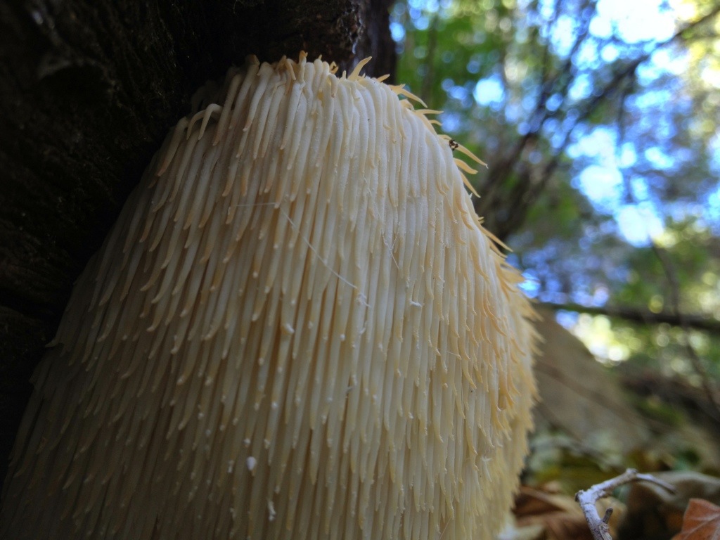 A hericium growing in the Santa Ynez Mountains. They have a pleasant, fruity mushroom fragrance and can taste like lobster or shrimp when picked fresh and sautéed in butter and olive oil.
 Meat.
Meat.