The Carrizo Plain was officially designated a National Monument a decade ago today on January 17, 2001.
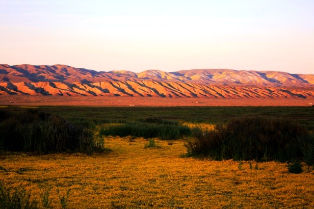
 Vast. Silence. Perhaps no two words more aptly describe the Carrizo Plain. As I stopped the engine and stepped from my truck I was struck by its immensity. The dirt road shot out before me into a needle point, far-off in the shimmering distance to the north, where it crossed the San Andreas Fault and disappeared at the base of the Temblor Range.
The sun-baked grassland swept westward, its individual stalks melting into the solid color of an immeasurable distance, and then abruptly stopping in a flat line where it met the faded, pastel blue of the horizon. So this is what the Golden State’s 400-mile long San Joaquin Valley once looked like, I thought, as I stood alone with my ears ringing from a silence that seemed to press in on me.
 Tucked away in the southeastern corner of San Luis Obispo County, the monument spans a quarter of a million acres of grasslands and rolling mountains. Sometimes called California’s Serengeti, this Golden State savannah offers refuge to an impressive list of large mammals including pronghorn antelopes, Tule elks and San Joaquin kit foxes to name just a few. Hawks, eagles and falcons soar through the thermals overhead, while the seasonal wetlands of Soda Lake attract numerous species of migratory birds including thousands of sandhill cranes.
 Pronghorn antelope on the Carrizo Plain, the second fastest mammal on Earth slower only than the cheetah, but can actually run at a faster sustained speed than cheetahs.
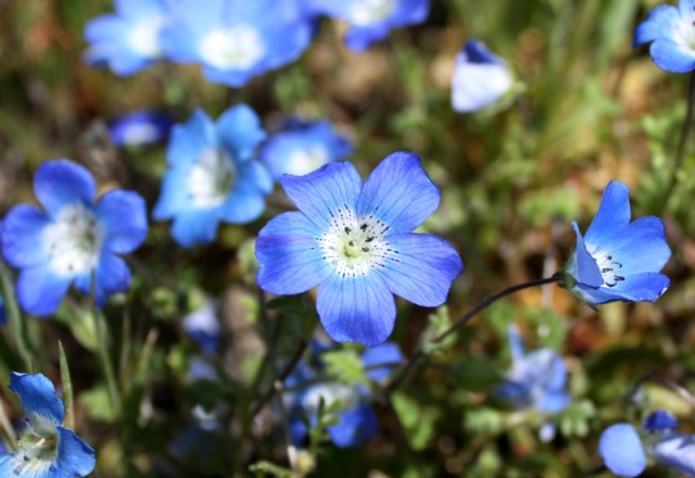
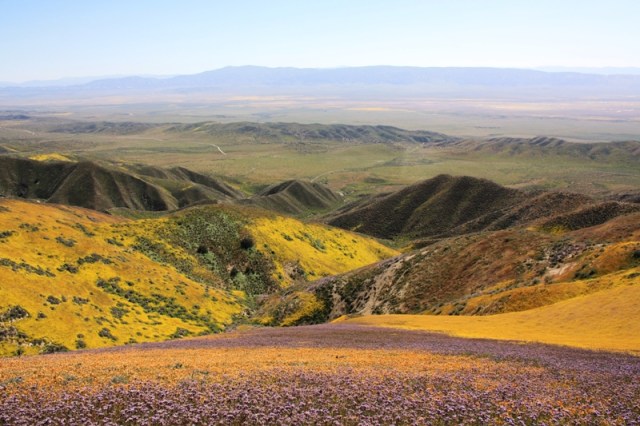
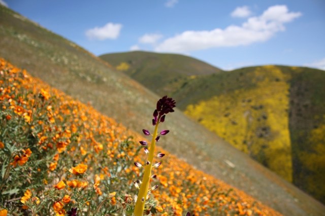
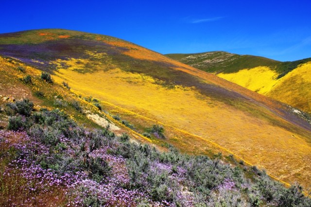
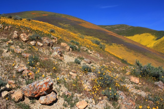
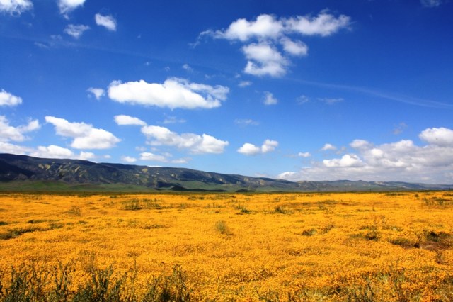
One of the more spectacular, yet fleeting, displays of the Carrizo’s grandeur comes in late winter and early spring. In March and April, the Temblor Range explodes in a glorious profusion of wildflowers. The annual bloom varies in intensity and timing depending on a variety of seasonal fluctuations, but for a few weeks the steep slopes of the hilly country transform into a polychrome patch work of brilliant color. The ephemeral burst grows thick enough to be seen for miles, which makes locating the sites with the best and heaviest blooms fairly easy.
Elkhorn Road runs along the base of the Temblors and provides excellent views of the flowers from a distance. A few other roads wind their way through and over the steep hills, the north facing side of which is lightly wooded. The roads in among the hills can get really steep and narrow and are at times little more than a Jeep trail in some particular places. I put my truck in 4×4 just so I was not constantly spinning my tires on the steep, hard packed grass covered dirt. Last year I was a bit late making it out to there, though, and the wildflowers had already hit their peak perhaps a week or two before. The photos below are from April 6, 2010.
 One of the narrow roads leading through the Temblor Range. This road winds its way to the top of the hills.
 A view of the road winding its way along the seam between two mountains.
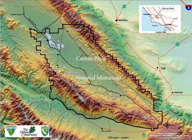
The blue line on the interactive map guide below marks the course of Elkhorn Road along the foot of the Temblor Range and access to it from Highway-33 or Highway-58.
Theodore Payne Wildflower Hotline ((818) 768-3533 or www.wildflowerhotline.org) to find the best places to view wildflowers in Southern and Central California. The hotline is updated every Thursday evening with new information on more than 90 wildflower sites.
Related Posts:
Figueroa Mountain and Zaca Ridge Wildflowers (March 2010)
Figueroa Mountain and Zaca Ridge Wildflowers (April 2009)
Soda Lake Reflections, Carrizo Plain National Monument














Thanks for your discussion of Carrizo Plain. Could you suggest where I might take my little VW beetle without getting stuck? I wd have to stick to the main roads, unless there are serviceable dirt roads that might make for an adventure without risk of mishap.
Any thoughts on when to look for wildflowers this year?
All the best.
Hello Judy. I would drive Elkhorn Road. The main few roads in the national monument are typically smooth and hard packed and would be no problem in a VW. From Highway 33 you can take Soda Lake Road all the way up the plain past the lake and then cut across on Seven Mile Road to Elkhorn Road.
The section of Elkhorn Road between Wallace Creek and where Soda Lake-San Diego Creek Road (Panorama Road) cuts across the Carrizo Plain can be particularly good for flowers.
The only concern, I think, would be the road cutting across the middle of the plain. From Highway 33 Soda Lake Road running up the length of the plain is no problem. Where Soda Lake-San Diego Creek Road (aka Panorama Road) branches off of it and cuts across the low lying Carrizo Plain is where it can get muddy and rutted up. I’m not sure what the conditions are right now. But you don’t have to go that way.
You might consider taking a drive up Cottonwood Canyon, too. It’s off Highway 166 west of New Cuyama. Mid-March is usually a good bet for the Cuyama and Carrizo Plain area. And at Figueroa Mountain you can drive right up to the fields of poppies and lupines. It’s usually pretty good there in April.
Hope that helps.
Hello, I very much enjoyed your narrative and the pictures. I visited the carrizo plain my self for the first time last march. As a photographer, my primary goal was to photograph wildflowers and I was able to find some great locations along hwy 58 and Elkhorn Rd. I also hiked into the Temblor mountains from Elkhorn Rd. with good results, but I’m very curious about the dirt road you describe that is navigable to the top of the Temblors. Does that exit off of Elkhorn Rd. ? The pictures you show are certainly intriguing and I don,t think it would be a problem as I also drive a 4×4 truck. Sincerely David Clemens
Hello! Your photos are amazing!!!! We were out at Carrizo last year and it was beautiful.
Any chance you know what Shell Creek looks like as of now (end of March 2011)? I am getting married next weekend and would love to take family in town to see some of California’s wildflowers-not sure if this is going to be a good year or not…
Thanks! Lauren
Hey Lauren. Sorry, I’m not sure about current conditions. I had actually planned on driving out to the Carrizo today, Sunday, but the weather didn’t cooperate. I haven’t been to any of the bloom sites out anywhere around there since mid-February.
Ok, thanks for the response! I will let you know if we venture out! Happy wildflower hunting.
Beautiful photos. I am hoping to get out on a hike this week end and would love to see some wildflowers. Have you found any information on where they are blooming now in SLO county?
Hi Robin. You might want to give a call to the following hotline if you haven’t already:
Theodore Payne Wildflower Hotline ((818) 768-3533 or http://www.wildflowerhotline.org) to find the best places to view wildflowers in Southern and Central California. The hotline is updated every Thursday evening with new information on more than 90 wildflower sites.
Thanks for the blogvisit! I enjoyed your photos. I recently spotted Carrizo Plain NM on a map and looked it up online because I’d never heard of it. Good to see such enticing pictures. I’ll definitely have to get out there one of these days!
Love the Carizzo Plain! It takes an effort to get there, but well worth the effort. Some years are especially spectacular!
Spectacular. I’ve never seen such expansive sweeps of wildflowers.
Great page! You clearly enjoy what you do. I will have to sharpen my skills a bit to create something close to what you have done. Congratulations.
Thank you! Glad to hear you like it.
Gorgeous photos and loved hearing about your trip. It’s been awhile since I’ve visited there, but I felt the same way about the vastness and silence. I’ve been enjoying your blog. I lived in SB County for quite a while and recently moved up toward Paso.
Hey Deborah. Thanks for stopping by, glad to hear you enjoy the content.
Hello,
Since I hurt my rib recently, I am unable to camp. I wish to drive to temblor ridges, if possible. But, I can’t camp this trip. Where might I find a hotel relatively closeby?
Hey Teri,
I’m not aware of any hotels nearby, but I’m not too familiar with that sort of thing around this area, so there may be places in New Cuyama, which is probably the closest, biggest town nearby. It’s pretty small, though.
You can drive along the foot of the Temblor Range in any car during the dry season, which is most of the year. There are a couple of dirt roads leading from the Carrizo Plain to the top of the Temblor Range, but it requires a four wheel drive vehicle with clearance. The roads into the Temblors are narrow and of questionable condition.
Thanks for the reply.
We do have a 4WD and plan on getting out on back roads. This is our first trip to this area and hope to see some wildflowers.
In my experience wildflowers out thataway come early. Best to get out there sooner rather than later!
How many miles is it from 166 to Elkhorn Road?
It depends on where on the 166 you are coming from; it’s a long road. It’s going to much long from the 166 out of Santa Maria. And much shorter from the 166 if you take Soda Lake Road from the opposite end of Carrizo Plain. I don’t know mileage off hand. You’ll want to find the distance from the intersection of Soda Lake Road and the 166 to Elkhorn Road. That’s going to be the shortest distance from 166 to Elkhorn.
Hi Jack, thanks for your response… I guess the question was not clear.
Yes, do you know the approximate distance from the intersection of Soda Lake Road and the 166 to Elkhorn Road? Thanks, Cary
I don’t really know that mileage. A quick use of Google maps says about seven miles. Here’s a link at what I’m looking at:
https://www.google.com/maps/dir/35.0299004,-119.4844067/34.9641575,-119.44548/@34.9966287,-119.5036939,16278m/data=!3m2!1e3!4b1!4m2!4m1!3e0
Thanks
Love this place too and need to explore more.
Thanks for the sharing your visit.