The Twelve-Inch Experience, Baron Ranch Corridor

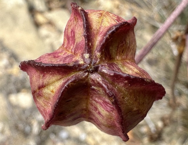
Humboldt lily seed pod.

“Adults follow paths. Children explore. Adults are content to walk the same way, hundreds of times, or thousands; perhaps it never occurs to adults to step off the paths, to creep beneath the rhododendrons, to find the spaces between fences.”

—Robert Macfarlane, The Old Ways

Some level of maturity is required to enjoy a long trail walk through a forest without venturing so much as a single step anywhere off the path, “immediately adjacent” to it.

To walk the line requires discipline and self-restraint. 

Who will remain separated? To only ever peek at from afar, like some kind of museum exhibit, never up close and personal. To ignore visceral yearnings. To never wander off the twelve-inch wide path.

Adults can appreciate or at least abide by such restraint in service to a greater cause. 

Children want none of it. Some adults don’t either, actually. 

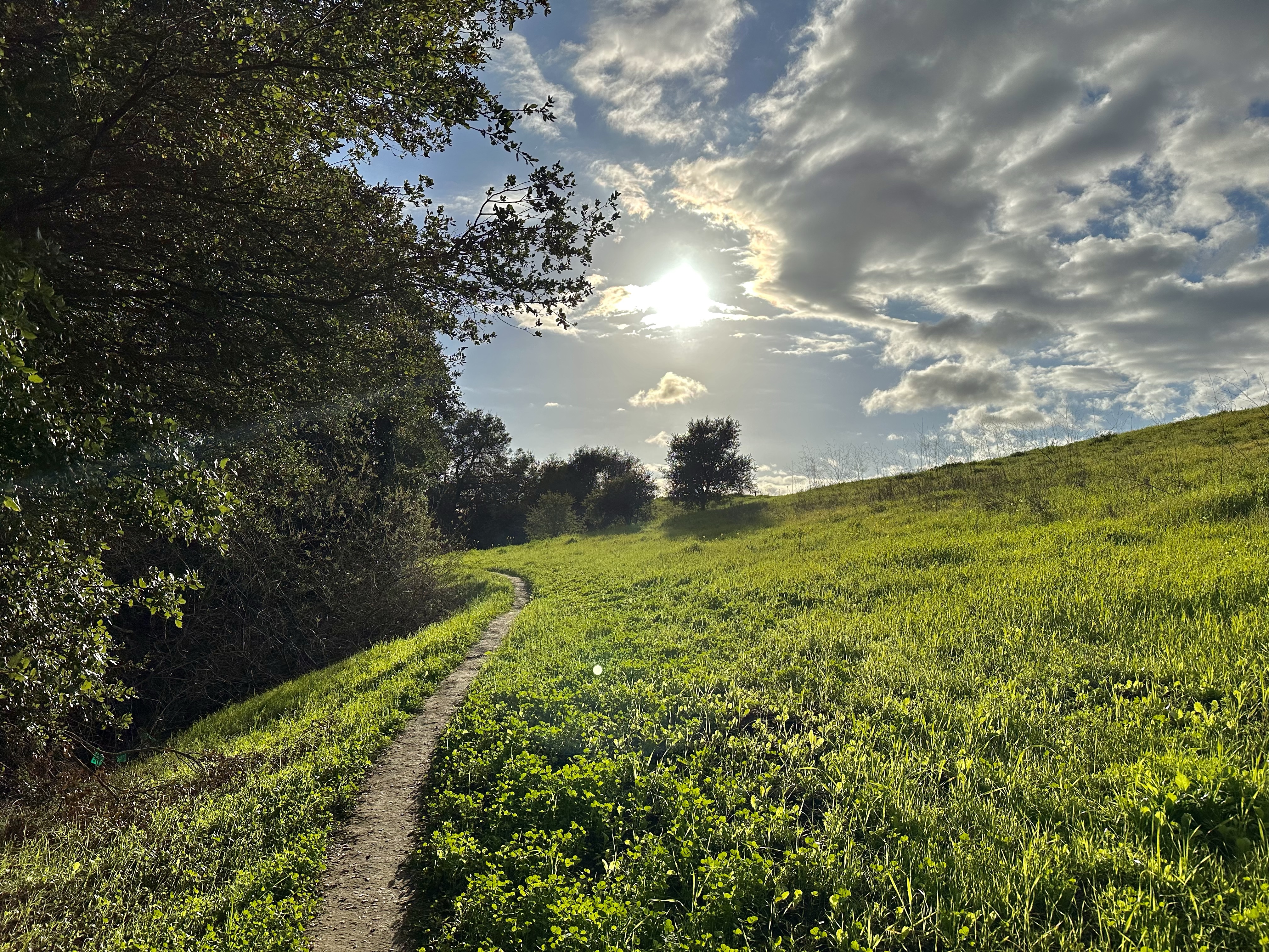
Immediately upon lower Arroyo Quemado Trail.

A fleeting moment of excitement struck one morning at the thought.

I’d take the kids for a hike where they had never been, within their own larger backyard in our county.

The thrill of novelty and seeing a new place for the first time. Very good! 

The good thought withered on the vine with the realization of how ludicrous the idea was, really. A wind past the teeth, head shaking sort of silly.

I couldn’t possibly expect my three children to remain on the twelve-inch wide path like subjects in a maze.

I would not want to enforce the rigid structure of an exclosure anyway, not here in this big forested canyon, where it clearly appears senseless and unnecessary.

And so we didn’t bother with the clipped and curtailed, the diminished experience that is the Baron Ranch corridor.

Calochortus fimbriatus. Guerrilla contraband imagery.

“The only area of the Ranch open to the public is the designated trail. Public access is prohibited in other areas of the Ranch. These areas, including areas immediately adjacent to the trail, are used for native plant restoration, wildlife conservation, and agriculture.”

County of Santa Barbara

That’s the County’s own super serious bolded emphasis, not added. 

The County is adamant! Just short of yelling in full capitals.

Their white-knuckled ardency is also seen in the oversized and numerous scowling signs along lower Arroyo Quemado Trail yelling DO NOT ENTER.

County employees prohibit stepping anywhere off trail in Baron Ranch under the guise of protecting nature.

Their exclosure of the people is based on nonsense, though, is it not?

Years pass and no restorative work whatsoever goes on anywhere along most of the nine miles of trails in Baron Ranch. 

And most of the forest at the so-called ranch will never be touched in this regard in any manner at all anyway, right?

The place is huge, much of which is no different than the surrounding national forest. 

The canyon is large and multi-forked, reaching from the Pacific seashore to the crest of the Santa Ynez Mountains.

Surely there’s room among the 1,083 acres of Baron Ranch to step off the trail now and again without unduly threatening something.

Are walking and conservation mutually exclusive?

Are we really supposed to believe we pose so significant a threat to canyon biology that freehiking cannot be accommodated?

That requires the willing suspension of disbelief.

Baron Ranch sign, entrance gate in background.

Is this not amusing if not alarming? 

The County acts with immoderate and disproportionate influence on local ecological dynamics, radically altering the land, reconfiguring coastal geography and watersheds, forest composition and the historical arrangement of plants and animals and fouling the air.

This is not to comment one way or the other in favor or opposition to these civil affairs surrounding Tajiguas dump. 

But to juxtapose the County’s bold and deep reaching actions on the Gaviota Coast with its treatment of walkers as if we are a problem, like some sort of barely tolerable existential threat.

Irony rings in the air. You can actually hear it when standing in Baron Ranch reading the sign suggesting visitors remain quieter, and not to upset the acoustic ambiance.

At the same time, one may hear the beeping of reversing bulldozers wafting over from Tajiguas dump next canyon over. The dump is the reason the County took ownership of Baron Ranch.

Good thing my children aren’t running around anywhere off the twelve-inch corridor hollering and having fun.

Could you imagine?

Plastic in County-made mulch at Baron Ranch, as seen here nearby the sensitive habitat sign.

Some of the larger plastic found in the mulch, collected in mere seconds from in and around native plantings in restoration work done in Baron Ranch. 

“Excuse me? You can’t be serious, man. You cannot be serious!”

–John McEnroe

If the condescension is not enough, the outrageous part may be seen in how the County of Santa Barbara is responsible for the spreading of microplastic trash in Baron Ranch. And in places all over elsewhere across the coastal littoral, which drains to the ocean, downhill and downstream of everything.

The County of Santa Barbara makes this microtrash mulch, which they sweet sell as “natural” and “ideal” and even suggest is “organic.”

The mulch is loaded with pieces of plastic.  It’s speckled with even smaller bits the closer one looks. 

What would a microscopic analysis of County mulch reveal? 

The City of Santa Barbara is a booster of the microtrash mulch program, offering rebates as encouragement.

This has gone on for years.

And so we ask the employees of both the County of Santa Barbara and the City of Santa Barbara, if they want to be bold and super serious about conservation, tell us:

How much microplastic trash has been spread county-wide in this manner?

The domain experts treat us like fools. Then they expect to be trusted and respected when they demand allegiance to their rules of exclosure.

Ventura County forest sign.

Posted in Santa Barbara | Tagged , , , , , , , , , , | 1 Comment

Figueroa Mountain Bug Bloom

Along the road to bugville in autumn. 
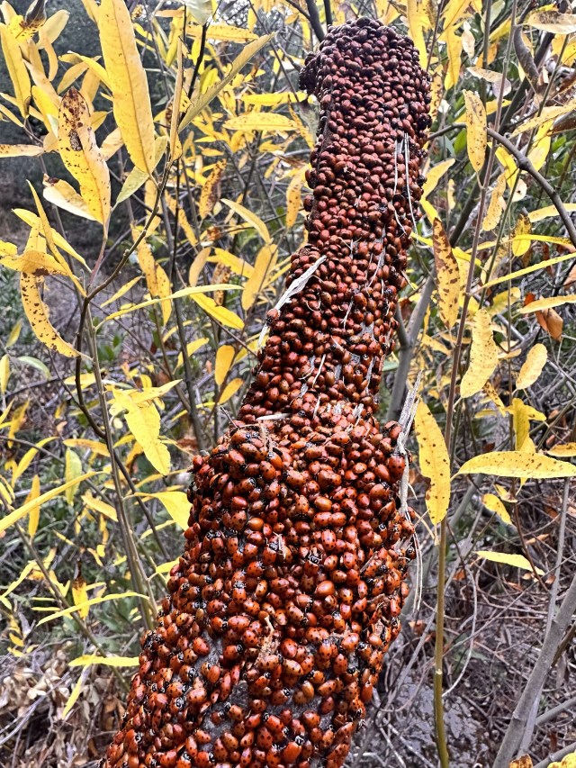
Springtime wildflower blooms on Figueroa Mountain capture all the attention.

But I’ve long marveled, too, at the winter ladybug blooms of the mountain.

December 2023

I hold onto a childhood memory of ladybugs blanketing big logs around Upper Bear Camp along the headwaters of Sisquoc River.

The bugs are one of only several memories of our long walk through from NIRA to Upper Oso.

Last year on Figueroa, ladybugs fluttered through the forest air on sunny afternoons so thickly in places I thought I might inhale them and had to cover my nose and mouth when passing through. 

I wonder if at times they might bloom in swarms so dense as to make hiking impossible.

NPR: A Swarm Of Ladybugs So Huge, It Showed Up On National Weather Service Radar

I see them more usually, however, clustered by the thousands on logs and branches and across the forest floor.

I once saw them en masse lining the individual stalks of blades of foot-tall grass that bent and swayed in the breeze under their weight.

February 2022

Posted in Santa Barbara | Tagged , , , , , , , , , , | 7 Comments

Discreet Sensitive Habitat Signage, Sespe Wilderness

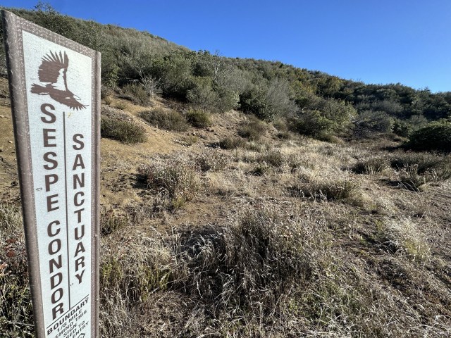
A thin sign in Sespe Wilderness only but several inches wide with not another sign in sight.

Once upon a time not long ago, following wildfire, thoughtful land managers in Ventura County reposted sliver-thin signs along Sespe Wilderness trail, there marking the condor sanctuary boundaryline.

This is federally designated critical habitat of the highest order.

What other wild creature in America has been the focus of more investment in time and money through as many decades to save a single species? A national icon.

A hiker walking beyond the boundary might accidentally drop a piece of shiny and wiggly plastic microtrash, which could be mistaken for food by a condor that might then choke or die a long, slow and miserable death by starvation from a trash-clogged gut.

And yet the sensitive habitat signs for the condor are rather discreet and few and far between. A light touch. 

In the size and placement and in the number installed the signs are respectful of place and of people.

Does doubling the size and number of signs, and placing them twice as close together, accomplish twice as much protection for red-legged frogs and southwestern pond turtles in Baron Ranch?

Some of the signs are placed in brush too dense for anybody but a masochist to even bother trying to enter. 

The arroyo is of no interest to average folks and uninviting in its overgrown appearance, but for the openess where the trail itself crosses.

And neither the frog nor turtle are currently listed under the Endangered Species Act like the California condor. 

So why the gauntlet of hamfisted signage? 

The gratuitous institutional glare of the Baron Ranch signs stand in stark contrast to the slim, embellished condor markers.

Would that when the next wildfire sweeps the canyon clear at Baron Ranch, less trace will be left by land managers, and instead their work will be accomplished with a lighter touch.

Why not?

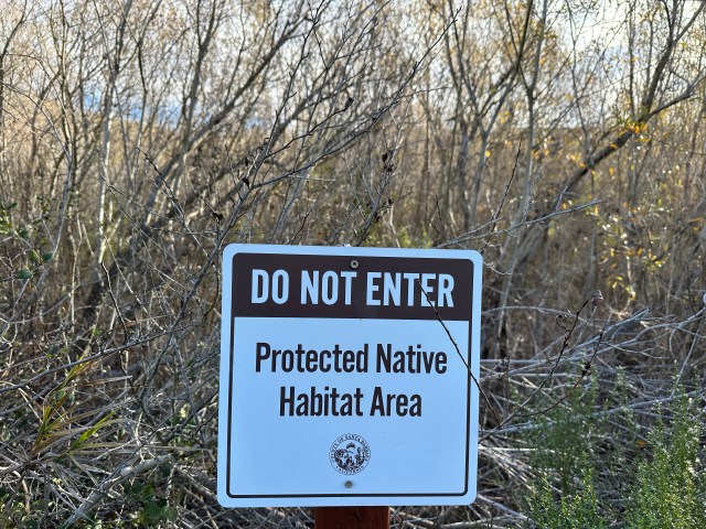
The overbearing sign installation along Arroyo Quemado Trail in Baron Ranch. A person can stand at one sign and see the next one not far off, on either side of the trail. At some point in the not too distant future brush trimming work will be required to keep some of the signs visible.

Related Post:

Big Bummer At Baron Ranch: Trashing the Place to Save It

Posted in Santa Barbara | Tagged , , , , , , , , , , | 7 Comments

Indian Head Test Pattern (1939)

In my years at University of California earning a degree in American history with a minor in Native American studies I never heard tell of the Indian Head Test Pattern.

I first learned of it reading Tommy Orange’s novel, There There.

The image on TV and its utility for the industry has been written about in fine detail, in matter of fact fashion. The use of a tool described.

In popular mainstream culture the stylized image is recounted with fondness and steeped in the warmth of nostalgia and Americana.

People suggest the cartoon chief was featured in a dignified manner or out of admiration and respect.

Native American author Tommy Orange offers a different perspective to consider.

An excerpt from There There:

“There was an Indian head, the head of an Indian, the drawing of the head of a headdressed, long haired, Indian depicted, drawn by an unknown artist in 1939, broadcast until the late 1970s to American TVs everywhere after all the shows ran out. It’s called the Indian Head Test Pattern. If you left the TV on, you’d hear a tone at 440 hertz—the tone used to tune instruments—and you’d see that Indian, surrounded by circles that looked like sights through rifle scopes. There was what looked like a bullseye in the middle of the screen, with numbers like coordinates. The Indian head was just above the bullseye, like all you’d need to do was nod up in agreement to set the sights on the target. This was just a test.

In 1936, Santa Barbara National Forest was renamed Los Padres. The same year the Santa Barbara Bowl was built to celebrate Old Spanish Days-Fiesta and the Padres baseball team was named.

The padres were celebrated as pioneers of civilization and domestication, taming the unruly wilds.

In 1939, the Indian Head Test Pattern was created to be broadcast on screens nationally.

It was just a test.

Related Posts:

The Case For Renaming Los Padres National Forest 


Renaming Los Padres: Names Of the 1930s

Posted in Santa Barbara | Tagged , , , , , , , , , , | 1 Comment

Spring Potrero Mutilated, San Marcos Foothills Preserve

Restoration travesty (January 2023)

“Paths are human; they are the traces of our relationships.”

Robert Macfarlane 

Channel Islands Restoration, her purported protector, deflowered the virgin.

A screaming outrage. A grotesque violation.

This was not restoration. This was mutilation.

I met a guy once. They took a sharpened piece of metal to the soft flesh of his face. He came out of prison looking like he had tried to French kiss Freddy Krueger without an invitation. 

That’s what they did to Spring Potrero in the San Marcos Foothills Preserve.  

Out came the long knives to carve a wicked, winding wound plumb through the heart of the small bowling pocket of grassland above the one-and-only spring.

The Preserve covers no less than 200 acres with miles of trails and this, of all places, is where they chose to plow out a jumbo-sized walking course.

There was no need for it. Another thinner trail had long existed, the people’s path, let’s call it.

Now, mind you, the experts will tell you the new walking course is for the birds.

And they’re right about that.

The original thin little footpath, newly decommissioned, but still regularly walked by the usual suspects. (January 2023)

The Channel Islands Restoration walkway looks like the work of a high school student striving to meet the soulless standard of some urban planning or design academy. 

The path is not organic and not natural, and it very much looks it. It looks corporate or institutional or of housing tract development origins. 

It looks nothing like the real, natural footpaths created by common walkers in our local open spaces.

The new walking course consists of mindless meanders, like the go-cart track at Golf’n’Stuff in Ventura or a racetrack, winding and weaving for no apparent reason other than to wind and weave and for distance.

It’s reminiscent of tricycle tracks at preschools.

It appears designed solely for those needless reasons alone, carved into the land without any care or consciousness whatsoever for its natural character and the aesthetics of place. 

Bachelor’s Button on West Mesa, San Marcos Foothills Preserve

Small signs placed in the potrero postinteritus made the dubious claim that the hideous new walkway had somehow increased the value of San Marcos Foothills Preserve. 

The new path leads nowhere remarkable or anywhere of interest. Nor does it serve to connect anything of import.

The plain simple truth is that there was no need for development of this caliber and in this particular spot so that the birds were given some consideration and protection.

And why locate a new trail crossing right over and through the headwaters of a creek anyway?

A seasonal seep flows from the potrero and joins runoff from the spring into the tiny drainage.

Go there this winter, once the coming El Nino rains hit, on top of the preload of last winter’s epic rainfall, and you might see the seep flowing from where the new trail crosses back and forth.

Don’t get me wrong. It’s not a creek bed. But the water does indeed flow out of Spring Potrero and it is visible, at times, toward the lower portion. Otherwise, the seep issues from the ground a little lower down slope, immediately east of and adjacent the spring site. 

Why even bother forever marring Spring Potrero in an open space otherwise consisting of 200 acres? Why here? Why not anywhere else if anywhere at all?

We walk the preserve, the two of us, five miles never retracing a single step and we still have plenty of trail options left for further distance if desired.

There was not a lack of existing trail beforehand, before the developers showed up many years later under the guise of restoration and enhancement. Not in overall total distance nor in variety of terrain and destination.

If any pathway was needed, then there was no lack of open space elsewhere to locate it.

“Paths are the habits of a landscape. They are acts of consensual making. It’s hard to create a footpath on your own.

Paths connect. This is their first duty and their chief reason for being. They relate places in a literal sense, and by extension they relate people.

Paths are consensual, because without common care and common practice they disappear: overgrown by vegetation, ploughed up or built over.

Like sea channels that require regular dredging to stay open, paths need walking.”

–Robert Macfarlane, The Old Ways: A Journey On Foot

The people’s path by contrast is organic and natural, a beautiful cultural creation that compliments the land.

Our path had been laid down one step at a time, by a multitude of people, over the course of years, each step by each walker a vote registering on the land like a signature to form the unspoken consensus of its most frequent users, who are closest to this place in body and mind, and then signed off on by all other walkers who followed thereafter.

Yet, beyond this raw democratic ideal, the people’s path is smart and discreet, skirting Spring Potrero and leaving it and the viewshed nearly untouched.

Our trail winds intelligently around the land sensitive to natural character and aesthetics, cognizant of Spring Potrero’s station afore the Santa Ynez Mountains when approaching from the west. 

When walking the original slim footpath the trail was hardly visible and Spring Potrero lay untouched before you, spotless in front of the mountain backdrop. 

That is no longer the case.

Sunset glow on an iris in the preserve.

People’s paths come into being as necessary, when necessary. Often times in casual defiance of the overwrought designs of urban planners. There is a name: desire paths.

The people’s paths are cultural creatures that live and die, shrink and grow, for better or worse, one footstep at a time. 

People’s paths grow in width as necessary, only when necessary. The path will begin its life looking little different than an animal trail. With use through time it becomes an evident human footpath, but remains thin singletrack.

If more people walk the path it may grow in size to accommodate the increased traffic, but only as much as is needed. Not by the guess work of a designer or laborers, but out of practical necessity by the people actually using the trail. People paths shrink and grow along the way depending on the surroundings. It’s never one-size fits all.

The people’s path chosen by many is by unintended consequence–by design of the invisible hand–never too big nor too small and never misplaced.

The people’s path is always just right, naturally.

The new walking course was at best a wild guess at what was needed, where it was supposedly needed, and decided on by a select few and then imposed.

View of Spring Potrero as it looked in 2016. 

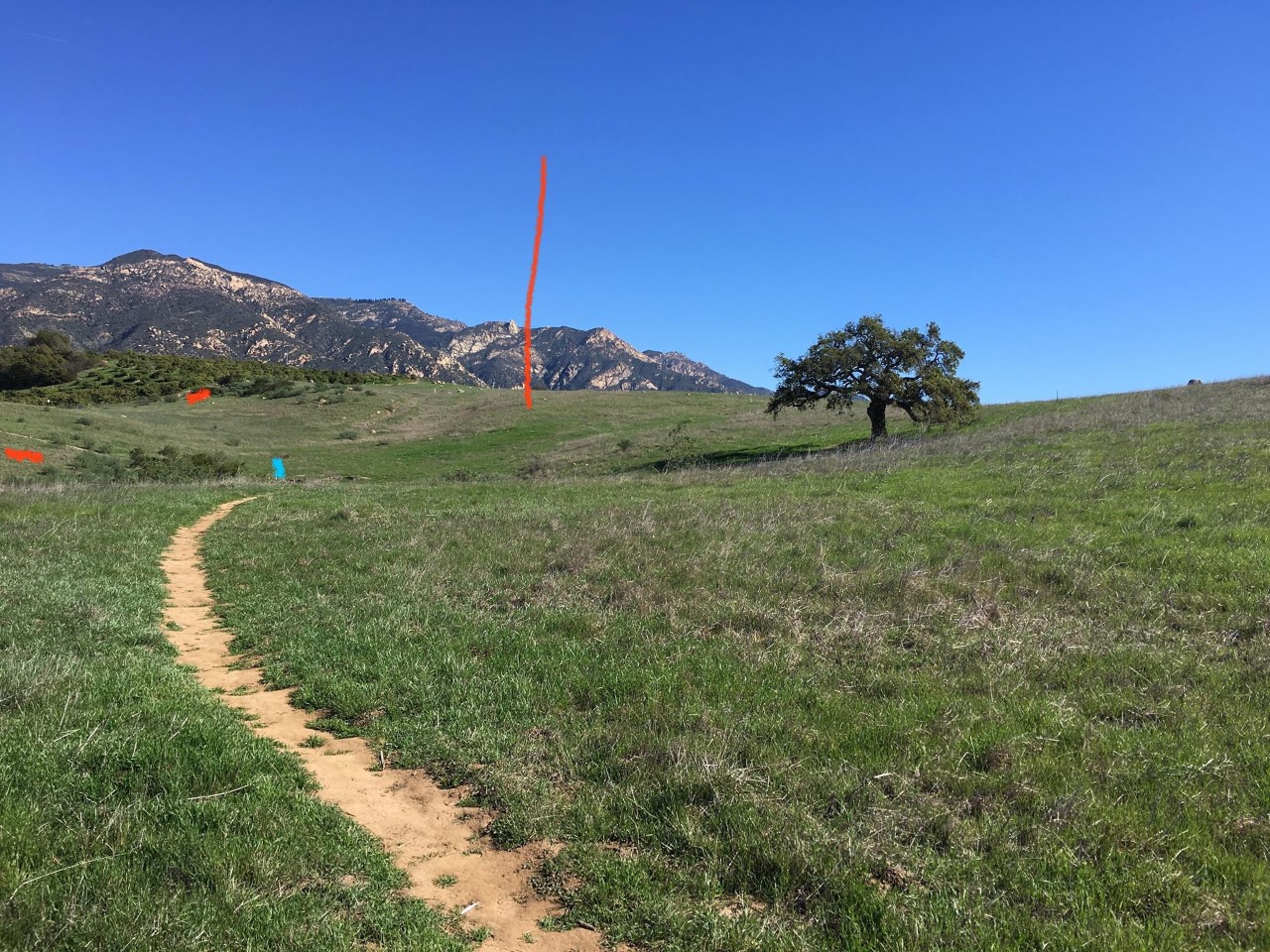
Looking over the spring denoted by the blue dot and onto bowling Spring Potrero noted by the large red line. The other two red slashes underline the course of the people’s path, hardly visible. 

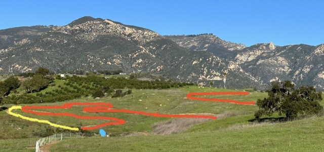
The view showing the course of the new pathway in red and the old trail in yellow. (January 2023)
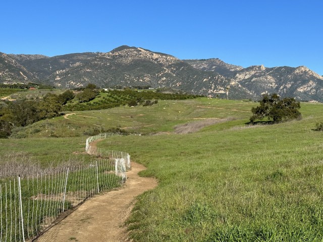
Mindless meanders.

I commented to friends online in January 2023:

Our trail of less consequence is hereby recommissioned. I saw a guy yesterday take our old trail and shun the new one. It’s not just me. It’s arrogant and ignorant what they have done here. And many are not going to go along with it. We’ll vote with our feet. And our passive resistance will be seen in the continued life of the trails they seek to terminate.

They stormed in like a bull in a china shop, rude and insensitive and destructive of people’s places and things.

They posted signs saying our trail was decommissioned and they chopped up the path trying to encourage non-use and natural reseeding of the grassland.

It has not worked. It appears it will not work.

People saw the signs and promptly recommissioned the old path and the trail has since been in regular use.

This was not restoration nor enhancement, as they left behind in our open space a far larger footprint than what existed beforehand, and they destroyed a defining feature of the land.

Posted in Santa Barbara | Tagged , , , , , , , , , , | 7 Comments