
 Motorcycle accident victim being airlifted to hospital from Highway 33.
On my way up Highway 33 to Pine Mountain I came around a corner and was flagged down by Los Padres Fire whose engine was stopped in the northbound lane. Half of a motorcycle lay in the gravel on the shoulder, its rear end somewhere not within sight. Several firemen knelt at the side of the road tending to a man laying somewhere in the bushes.
I was the first vehicle to come upon the scene just after LPF got there. I sat in my car, front row, watching the highly tuned, well-oiled rescue machine comprised of various first responders rapidly converging on the scene topped by the helicopter thumping up the canyon and landing beside the road. They had the victim secured, stabilized and in route via airlift to the hospital in relatively short order and traffic once again moving.
After seeing that, it would take a lot for the short hike I had planned to turn out any other way but just fine. A terrible day hiking always beats being airlifted to the trauma center.
 Reyes Peak (7,514′)
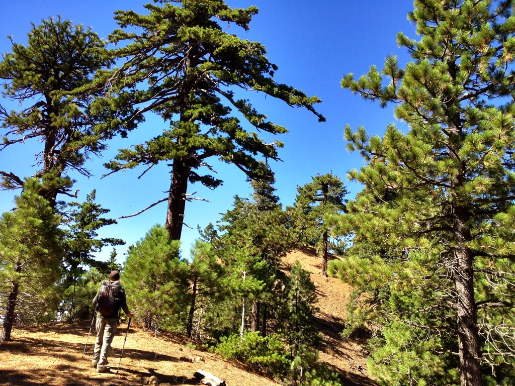
The Reyes Peak Trail along the spine of Pine Mountain Ridge out to Haddock Mountain must rate as one of the finest four mile stretches of hiking trail anywhere in the southern Los Padres National Forest.
That’s my impression, anyhow, based on my own limited experience. Thinking I may be overstating it, however, I checked what Craig R. Carey had to say in his recent trail guide book, “Hiking and Backpacking Santa Barbara & Ventura.” According to Carey, the Reyes Peak Trail along the northern slope of the peak is “quite simply one of the most beautiful stretches in the southern Los Padres.”
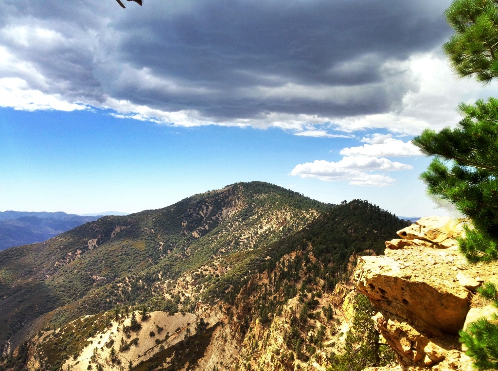
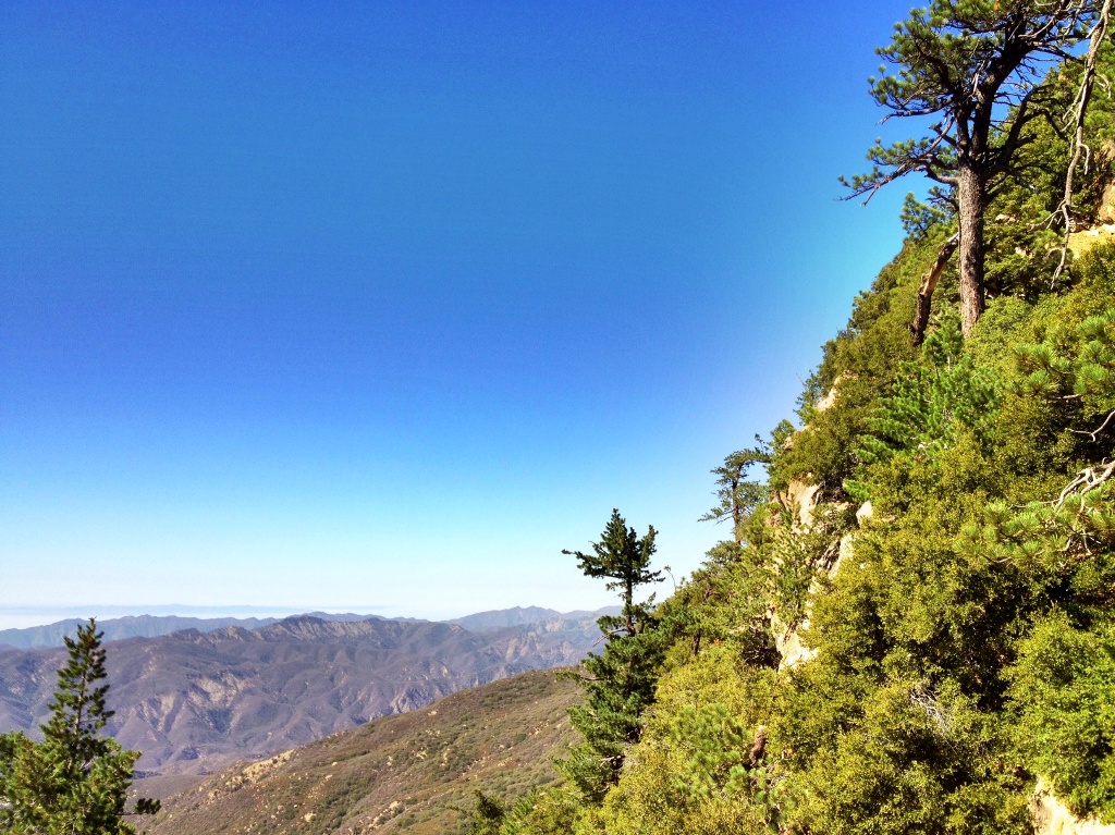
The area is exceptional for its elevation of around 7000′, its clear trail through wide-open conifer forest, large rosy orange sandstone boulders and expansive views of Cuyama Badlands to the north, and the Sespe Creek watershed, Pacific Ocean and Santa Barbara Channel Islands to the south.
Here off-trail wandering and exploration is not just possible but easy, the open and sparse understory of the pine forest invites it. This stands in stark contrast to so much of the chaparral country that dominates the lower elevations in the LPNF, which is mostly impenetrable and where even official trails themselves are often overgrown and hard to follow.
The upper reaches of Pine Mountain also offers a cooler locale for summer hiking. When the lower elevations are broiling in 90 degree heat the ridge at elevation can be in the mid 70s and there is always a tall tree nearby providing a shady place to rest.

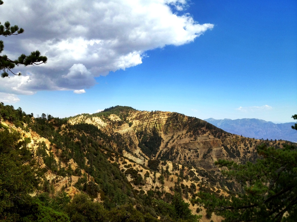
 Wind gnarled pines along the use trail to Reyes Peak, the Cuyama Badlands in the distance beyond.
 Cuyama Badlands
 Reyes Peak summit.
 Ice can stove on Reyes. (The Ice Can Stove: A Brief History)
 Haddock Mountain
 Trailside view.

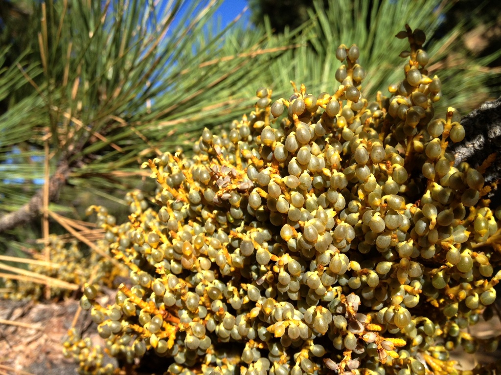 Dwarf mistletoe. The globules are liquid-filled and contain seeds which are sent flying at up to 60 miles an hour when they burst. The seeds stick to nearby trees within range, germinate and then root into the new host.
 Haddock Mountain

 Haddock Mountain showing some of its characteristic green lichen covered rock faces.
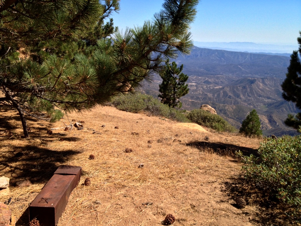
 With the view and sound of a light intermittent wind through the pine trees this little shaded flat along the edge of the cliff was a choice spot for a break.
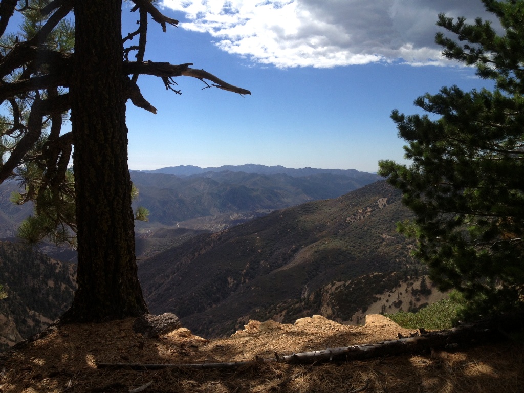
 Mountaintop view over Sespe Creek watershed and, in the distance, the fog covered Pacific and Santa Barbara Channel Islands.
 Haddock Mountain summit.
 Haddock Mountain summit (7,431′).
Related Posts:
Haddock Mountain Descent to Sespe Creek via Potrero John Creek


I have always wanted to hike this trail. I am definitely going to have to do it next time I am down in the Ventura area. Thanks for posting these images!
Great post full of interest and beautiful photos. Hope that motorcyclist was okay!
Carol.
Perfect timing, Jack. I’m leading a Pine Mountain Nature Hike on that very trail this Sunday, September 22: http://herbwalks.com/ai1ec_event/pine-mountain-herb-hike/?instance_id=505.
I see from your new banner photo above that you found beauty even in the dreaded dwarf mistletoe. It’s a serious threat up there. The suppression of fires that would regularly burn through the understory has allowed the mistletoe to move up into the crowns of the trees where it is virtually impossible to remove without taking down the trees. And the higher it goes, its seeds spray out to that height in neighboring trees.
Thanks for sharing this post. It reminded me of my own trip to both peaks over a year ago. I have been thinking about returning ever since, to backpack in the area.