
 The Chumash pictograph panel at Arrowhead Springs. The arrowhead-shaped mineral stain surrounding the rock art points down to a spring issuing from under the boulder.
 Santa Barbara county-wide precipitation for the 2013-14 water year stands at 41 percent of normal or 8.03 inches. The driest year on record was 2006-07, which measured in at 6.41 inches. (Third driest was 1924 with 6.43 inches.) (County of Santa Barbara)
Last season’s county-wide rainfall totaled 46 percent of normal and the year before that it was 66 percent of normal. Not only has far less than normal precipitation fallen in the last three seasons, it has gotten drier each consecutive year.
Earlier this month it was reported that 80 percent of California was in “extreme drought.” Santa Barbara County is now experiencing even worse conditions and has reached the next official level, “exceptional drought.” In addition, it was also reported that from January through June, the vast majority of the county was unusually warm with “record high temperatures.”
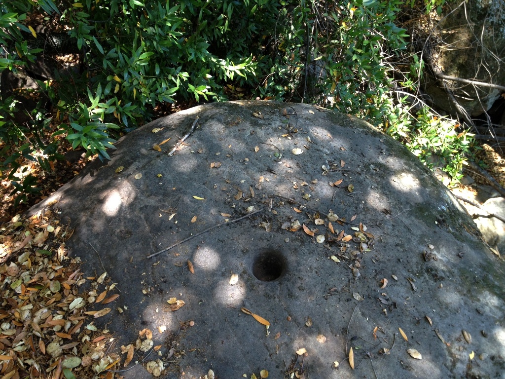 One of several bedrock mortars at the spring site.
On a recent July visit to Arrowhead Springs Chumash rock art site, I found the spring no longer held standing water above soil level, but the ground was still damp. I was able to dig out a couple inches of gravel and water quickly filled the small hole.
Would a body be in need of a drink, the spring would provide in this exceptionally dry summer season. Though unlabeled on an official USGS map, and certainly not a perennial gusher, Arrowhead Springs appears to be a fairly reliable seep. The well-hidden shady spring with views of the Pacific Ocean and Santa Cruz Island was obviously of great value to some Chumash Indians for this reason.
The degree of severity of the current drought in California has not been seen in over 120 years, according to NOAA. It’s a good year to witness the nature of these exceptional times in the Los Padres National Forest, and to measure them against past experiences during rainier years, and to see how the drought affects the land, its plants and animals.
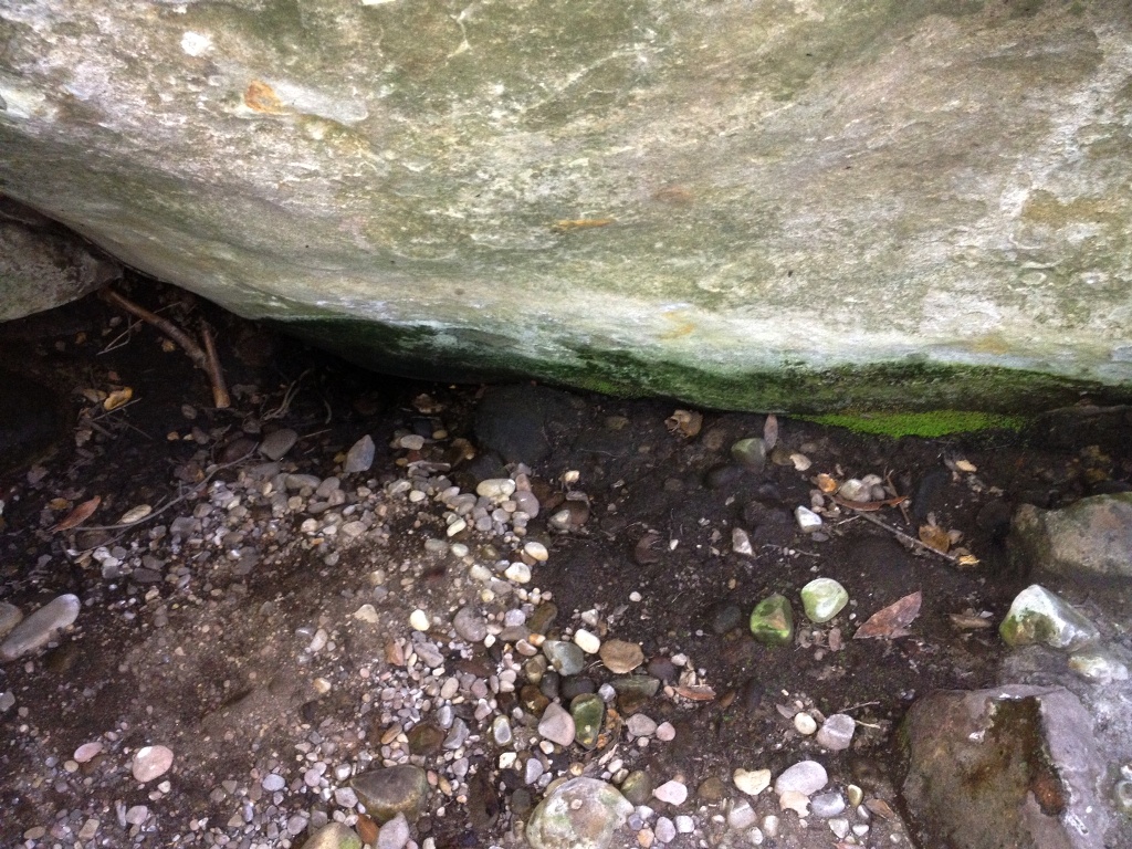 A view of the seep at the base of the boulder, moist but no pooled water.
 Reaching back under the boulder, digging out a couple of inches of sediment with a stick, the seep filled a small depression with water within seconds.
Related Post:


Even we’re having a summer over here this year so I can imagine you’ve got it hotter and drier than normal!
Carol.
V Marks The Spot!! Great news to hear Arrowhead Spring is still worthy of quenching thirst (even in the driest of times) I share you sentiment; it is remarkable to witness just how resilient certain pockets of the LPNF are. I recently dropped in for a visit at the Knapp site (also in the AS neighborhood as) and confirmed the nearby spring also remains in service. I would venture to say this is a common theme present at a majority of pictograph sites. The Chumash culture lived along the Southern California coast for a millennia (or more); I think it would be reasonable to assume they dialed in some of the best water-sources around.
Hey M. I also stopped by the Knapp site and have a post coming up about that and a heroic water rescue I performed while there to save a small life.
Research reported by the University of California earlier this year about the California paleoclimate record suggests that the climate used to be much drier, that the last 150 years were rainier than the previous two millennia, that the current drought is bringing our region back in line with what was a more “normal,” in the researcher’s words, climate pattern. Based on this data, it seems reasonable to conclude that fickle spring sites today, as well as all creeks in general, may well have been more reliable, stronger flowing sources of water in centuries past.
Very Interesting; should this come to fruition….. we better step up and get to work in the adaption department. Plenty of lessons to learn from the land, plants and animals!
Look forward to seeing the Knapp post.