The Sisquoc Falls: A Little Known Region in California Explored (1884)

Sisquoc Falls
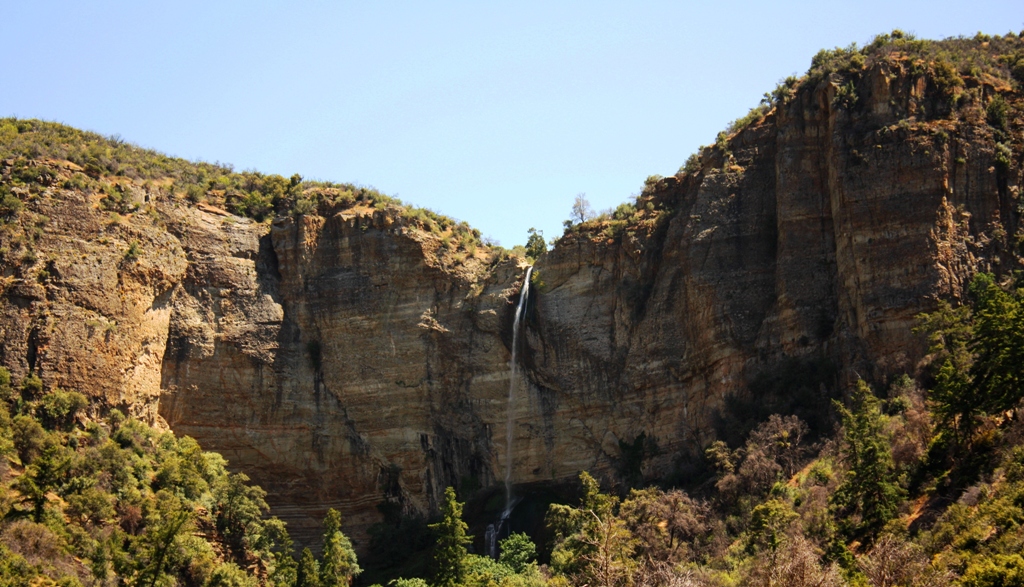
Sisquoc Falls, located in a restricted condor sanctuary in the San Rafael Wilderness, is officially off-limits to the general public.

The following narrative was originally published in the Santa Maria Times in 1884. It chronicles the bushwhacking exploratory adventure of a group of men who fought their way up Santa Barbara County’s remote, wild and trailless Sisquoc River to its headwaters and surrounding mountains.

Locals with experience hiking Santa Barbara County mountains, and who well know the brutally impenetrable and lacerative nature of chaparral, may find it humorous that the explorers warn readers, “we advise anyone undertaking the trip to take along a sheet-iron suit of clothes.”

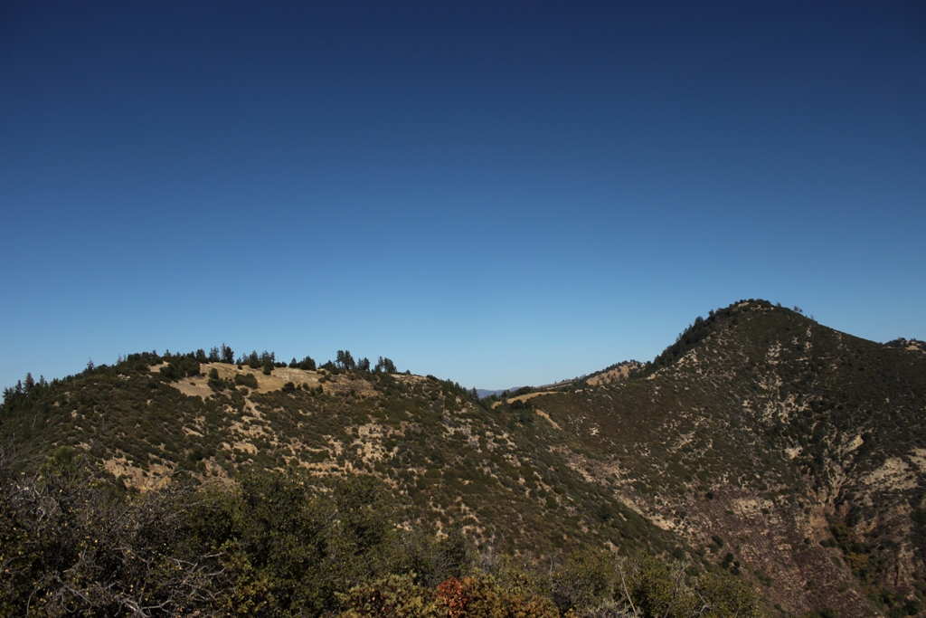
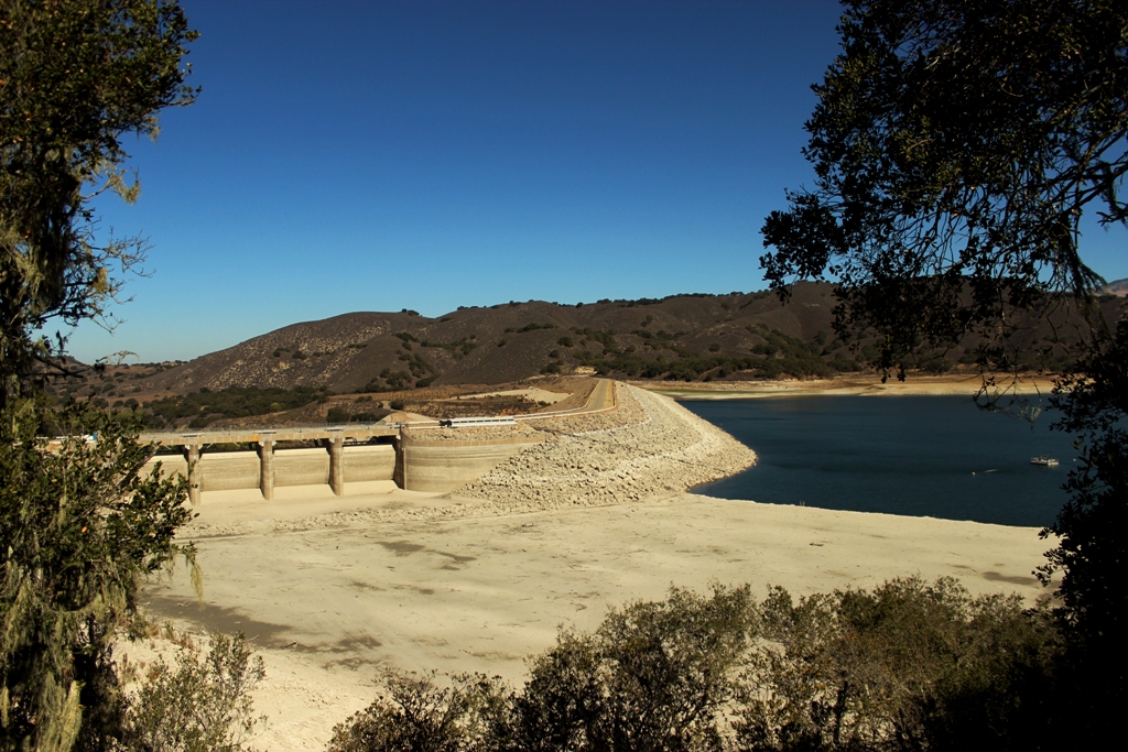
Hiram Preserved Wheat, mentioned by last name in the story as a guide, was “the patriarch of the Sisquoc homestead community,” write Blakley and Barnette in their book, “Historical Overview of Los Padres National Forest” (1985). He was known to the pioneers of the Sisquoc River area as “Old Man Wheat” and originally came from Potawanie County, Kansas. Today, a grassy and steep, pyramidal mountain overlooking the Sisquoc River is named in his honor, “Wheat Peak.”

The other guide mentioned, Forrester, was another member of the Sisquoc homestead community, Edward Everett Forrester. He was one of three people chosen to form a board of trustees for the community’s newly constructed schoolhouse in 1893. (Manzana Creek Schoolhouse 1893)

Wheat Peak, Sisqouc River Manzana Creek
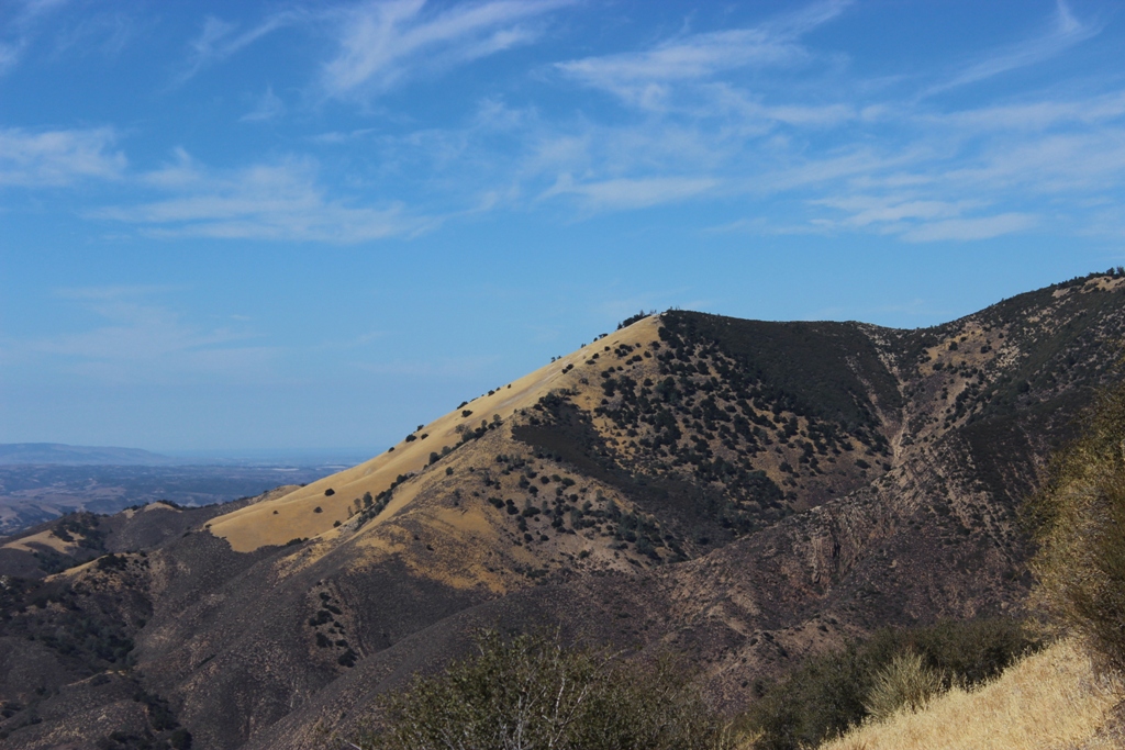
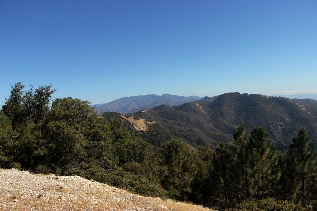
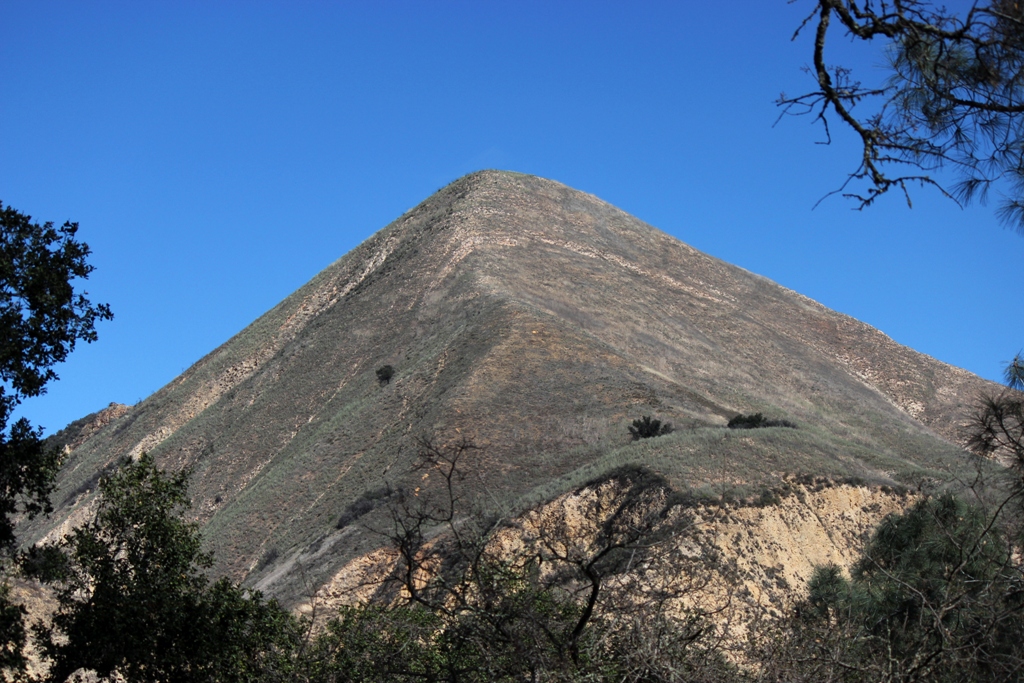
Wheat Peak, as seen from Manzana Schoolhouse, looms over the Sisquoc River which flows along its base.

The Sisquoc Falls: A Little Known Region in California Explored

Having heard so many conflicting reports about the wonderful scenery at the headwaters of the Sisquoc Creek, we, in company with Messrs. Wheat and Forrester, concluded to make a thorough exploration of that section, which has until lately been almost a terra incognita to even the oldest settlers, owing to the dense chaparral which covered the mountains on all sides, and made it almost inaccessible until an extensive fire swept over the several hundred square miles about there. We supplied ourselves with a necessary outfit, mainly blankets, Winchester rifle and salt, mounted the hurricane deck of our favorite caballo and the first day reached Mr. Wheat’s ranch, 35 miles from Santa Maria.

Los Padres National forest cascade waterfallThe next day while passing through the narrows, where the canyon is only seventy-five feet wide, the walls above towering hundreds of feet, we met with a slight accident in the same place where two other horsemen had come to grief only a few days previous. On one side a trout pool ten or twelve feet deep, on the other a shelf of slippery soapstone, to cross at an angle of 45 degrees. My horse’s feet slipped, and first the rifle went clattering down the slope, horse and rider rolling after in inextricable confusion. The rifle went off, striking the horse, fortunately missing a vital part. A mile further on we reached Mr. Robert’s camp and were soon supplied with a remount.

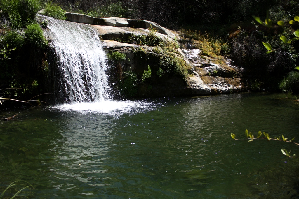
After passing the narrows we had to cut a trail for miles until reaching the burned country above the main forks of the river. Ascending the south-east fork about twelve miles from the river we came to Ventura Fallas we named itfrom the great number of them about there. The gorge at the foot of the fall was wild and picturesque in the extreme. Huge boulders and fallen trees, with occasionally a cascade varying in height from ten to one hundred feet to climb around. Grizzly bear tracks were quite plenty, but no grizzlies came in sight on the top, nor were we hunting any.

We climbed above and measured the main fall and found it to be 480 feet in heighta sheer descent with about 30 miner’s inches of water flowing over it. The stream falls about 2,o00 feet in two miles and a half, making a great number of beautiful cascades. The pool below the fall is 80 feet long, 40 feet wide and upwards of thirty feet in depth, clear and cold as ice, and so sheltered by the overhanging bluffs that the sun rarely shines in it.

Stringer_of_Steelhead_Trout_Upper_Sisquoc_River_1916
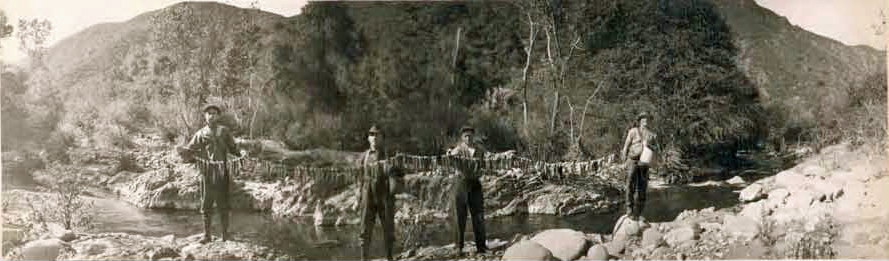
Fishermen displaying their catch, or plunder depending on your perspective, along the Sisquoc River (1916). The waterway is now an officially designated Wild and Scenic River. Fishing is no longer legally allowed in an effort to protect native southern steelhead, which are an endangered species and cling to existence today at about one to two percent of their former population size.

Near the top of the bluff, and at an elevation of 4,000 feet above sea, is an old beach line about fifty feet thick of rocks and marine shells deeply cemented together. This is the fifth well defined beach line to be found at the various altitudes between this place and the summit at the San Rafael range, all of them showing a different age and different formation of rocks. We found marine shells, etc., in the sandstone at the extreme summit of the range, at an altitude of over 5,000 feet.

Climbing the mountain above the fall we found to be terrific work; the dense chaparral partly burned and partly grown up again, was impossible to get through without chopping for miles. Near the summit of the range, between the Sisquoc and the Santa Ynez, we found a belt of fine timber on the northern slope of the mountain, about three fourths of a mile long and half a mile wide. We made a thorough examination of the whole grove and found it to consist mostly of the yellow pine to be found at certain altitudes on all mountains in California. Quite a number of the finest kind of sugar pine, with a few scattering firs and cedars, the latter being mistaken for redwood by an experienced woodsman, with a few oaks intermingling. We made a partial count of the grove and estimated the number of trees fir for milling to be from 9,000 to 10,000, the majority of them being from three to five feet in diameter.

After a careful search, we could find none of the unmistakable traces which a white man leaves behind him and concluded that the place has been hitherto very rarely visited by them. In one place were three cedar stumps which had been cut at least from 50 to 75 years, judging from their state of decay. It was done with a dull ax by Indians, probably to make bows from.

Sisquoc River tributary waterfall
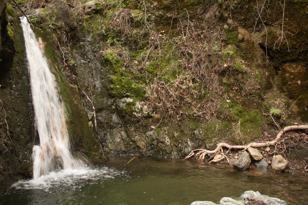
A clear, cold and deep pool along a tributary of the Sisquoc River.

The slope is so steep that we could find no place level enough to spread our blankets without shoveling, except at the extreme summit of the mountain. There we had a magnificent view of the whole surrounding country. To the south and west lay the Santa Barbara Islands. Far out across the Mohave Desert, upwards of 200 miles distant, the Providence Mountains were plainly seen. To the northwest the wide sweep of the San Joaquin Valley, on the further side the Sierra Nevadas, the snow-capped summit of Mt. Whitney and other lesser peaks, while in the northwest lay the coast range, a succession of sharp ridges and steep canyons, covered with dense chaparral for hundreds of miles, with here and there a beautiful valley nestling below.

The day was exceptionally clear, and the prospect well repaid us for all the trouble of getting there. The following day we tried to ascend the main south fork of the creek, which is even a rougher and wilder gorge than the other, if possible. After climbing a mile and half we came in sight of another fall from 250 to 300 feet high, considerable water flowing over it. We had to give it up as a bad job that day, and we advise anyone undertaking the trip to take along a sheet-iron suit of clothes.

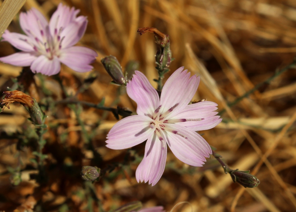
Those falls are about 65 miles from Santa Maria, and the timber belt spoken of about 70 miles. On coming back to camp we found one of the party, Mr. Roberts, in chasing a wounded deer had broken a bone in his foot, compelling us to start out as soon as possible. In another branch of the creek we found a small grove of genuine sugar maples, some of them two feet in diameter, the only natural grove of the kind we ever heard of in California.

Posted in Santa Barbara County | Tagged , , , , , , , , , | 6 Comments

Grass Mountain & Zaca Peak Via Birabent Canyon

The environs of Figueroa Mountain feature a diverse range of landscape. Open rolling grassland, gravely slopes sparsely studded with moss and lichen covered oaks, other nooks holding denser stands of oak and conifers, flowing creeks in the shady sycamore canopied canyons, piney peaks, and spectacular wildflower blooms in spring that can be seen from miles away.

Following any one of the many short trails that wind and weave through this area of the Los Padres National Forest takes hikers, in short order, through an outdoor realm of varied habitat like few other areas of the local forest.

Following below is a photo essay from a recent hike to the top of Zaca Peak from the mouth of Birabent Canyon on Alamo Pintado Creek. (This hike traverses private property and requires a permit from Midland School.)

Figueroa Mountain foggy RoadMorning fog along lower Figueroa Mountain Road.

Zaca Peak Grass Mountain mapBuck Figueroa Mountain Los Padres National Forest

Grass MountainGrass Mountain as seen from La Jolla Trail.

Grass Mountain Santa Ynez ValleyGrass Mountain Zaca PeakGrass Mountain and the ridge leading to Zaca Peak.

flower Figueroa Mountain

Tarantula Figueroa MountainTarantula sunning on the trail.

Tarantula burrow hole denTarantula burrow.

Grass Mountain Zaca Peak Birabent CanyonGrass Mountain with Zaca Peak barely visible behind it to the right.

Grass Mountain Zaca RidgeThe lone oak before the wall of Grass Mountain.

Grass Mountain TrailUp.

California golden state dried oats grassGrass Mountain view Figueroa MountainA thin finger of maritime fog from the Pacific still lingering far up the Santa Ynez Valley, the marine layer looming over the Santa Ynez Mountains in the distance.

Grass Mountain view Santa Ynez ValleyTrail leading off the top of Grass Mountain looking over Santa Ynez Valley.

Grass Mountain FigueroaLooking down the face of Grass Mountain.

Grass Mountain summit FigueroaGrass Mountain summit.

giant acorn

Zaca Ridge Zaca PeakZaca Ridge and Peak seen from atop Grass Mountain.

Zaca Ridge TrailTrail along top of Zaca Ridge.

Zaca Peak Zaca Ridge TrailZaca Peak

Zaca Peak summit viewThe view from Zaca Peak summit looking over Grass Mountain and the Santa Ynez Valley toward the Pacific Ocean.

Zaca Peak view Figueroa MountainLooking east from Zaca Peak.

Related Posts:

Birabent Canyon and Grass Mountain
Figueroa Mountain Wildflowers
Toddling Down the Davy Brown Trail
Edgar B. Davison’s Cabin (circa 1900)
Backcountry View From Figueroa Mountain Summit

Posted in Santa Barbara County | Tagged , , , , , , , , , | 11 Comments

Seasonal Change In Wildflower Fields of Figueroa Mountain

Figueroa Mountain WildflowersMarch 2013

Figueroa Mountain summer hikeOctober 2013

Figueroa Mountain Wildflower BloomFigueroa Mountain summer hiking

Posted in Santa Barbara County | Tagged , , , , , , , , , , | 1 Comment

Deluge and Drought In Santa Barbara County

Cachuma Lake Bradbury Dam droughtCachuma Lake at Bradbury Dam, September 2013. The reservoir is well below the floodgates and currently less than half full.

It seldom rains in Santa Barbara. “Probably the most striking feature of Santa Barbara County,” a story published in the Los Angeles Herald in 1897 notes, “is absence of rain during most of the year.” The lack of rain has been particularly acute the last two years.

Santa Barbara county-wide precipitation last season measured in at 46 percent of normal marking the second consecutive water year of below normal rainfall. The lack of precipitation at Gibraltar Dam set a record low beating out the previous record set in the 2006-07 water year, which is measured September 1 to August 31. Current capacity at Gibraltar Reservoir is a measly seven percent.

Yet, as Santa Barbara County Water Agency manager, Matt Naftaly, noted earlier this year of the current dryness, “this is a normal fluctuation.” It may not rain often, but when it does sometimes it really does! Despite the current droughty conditions, over the last fourteen seasons the county-wide rainfall total amounts to about 95 percent of normal for the period.

Cachuma Lake dry drought 2013The east end of Cachuma Lake is currently dry.

Santa Barbara County Rain TotalsSanta Barbara county-wide rainfall totals showing the wild fluctuations from year to year. (County of Santa Barbara)

Santa Barbara Gibralatr Reservoir Historic Rainfall GraphGibraltar Dam rainfall history showing 2013’s record low. (County of Santa Barbara)

The pioneers of the Sisquoc River, a watershed in the Santa Barbara County backcountry, were driven out of the area in large part due to the hardship caused from the cycle of deluge and drought characteristic of the region.

“The environment was a big factor in the community’s inability to survive,” Blakley and Barnette write of early Sisquoc residents in their book, “Historical Overview of Los Padres National Forest” (1985). “Years of heavy rain and flood were followed by dry years.”

Newspaper articles from the nineteenth and twentieth centuries chronicle the dramatic ebb and flow of precipitation through the years.

San Francisco Call, January 28, 1904:Santa Barbara droughtArizona Republican, March 08, 1911:Santa Barbara County floodsSanta Barbara County floodsAbout 150 years ago, a severe drought reshaped the socioeconomic landscape of Santa Barbara County ending forever the era of large cattle ranches, and helping usher in a new period of smaller landowners and development.

The Great Drouth

The returning [Civil War] soldiers found in Santa Barbara and in the other cow counties of the south a problem of rehabilitation more serious perhaps than Southern California was ever again to know. The stark, hot hand of drouth had, during their service in 1864, swept over the Southland, destroying the herds and bringing to a tragic close the pastoral life of old California.

Three successive dry seasons had left the land so parched that the grass did not come forth in the spring and around the faint green of disappearing water holes and ciénagas the starving cattle congregated literally by thousands, only to perish of starvation. Everywhere the plains were strewn with the fallen creatures and their bleaching bones. Prosperity seemed to have disappeared forever. …

Over two hundred thousand cattle had measured the wealth of Santa Barbara in 1863. Less than five thousand head were alive to munch at the grass that sprouted after the rains came in the winter of the following year.

The day of the native California land barons was brought to a close. The entire economic life of Southern California was altered. Cattle raising as the distinctive industry of the Southland was ended forever, and range lands fell so low in value that some of the southern counties assessed them at 10 cents an acre. It meant the beginning of partition of the great ranchos.

In Santa Barbara as elsewhere in the former cow counties, the land was opened for the first time for small farms and the march of industry which began after 1869, when the combined lure of cheap lands and easy travel over the new trans-continental railroad started the second tide of immigration to California.”

Santa Barbara, Tierra Adorada: A Community History (1930)

Cachuma Lake drought 2013 water levelThe full capacity waterline is high and dry at Cachuma Lake.

Growing up in Santa Barbara I had the drought conscious water saving mantra, “If it’s yellow let it mellow, if it’s brown flush it down,” burned into my brain as a boy. People use to, and some still do, paint their lawns green or replace them with artificial turf. The other side of the climatic coin included the torrential rains of El Nino years, the flooding, mudslides, road washouts, and big surf and deep snow.

The yo-yo back and forth between the extremes of deluge and drought can leave the Los Padres National Forest lush one season and desiccated the next. Some years it’s possible to hike deep into the hinterlands throughout summer with little concern about hydration, as streams and springs flow. Other years lack of water severely limits hiking options for all but the most hardy and determined trekkers.

Heading into the new water year, with the last two seasons of below normal precipitation and resulting current drought conditions, much may hinge on what does or does not fall from the clouds this winter.

Posted in Santa Barbara | Tagged , , , , , , , , , , | 1 Comment

Searching for Soul Outside the Cage

Solo hikingStillman walking point in the San Emigdio Mountains.

“The environment we’re used to is designed to sustain us. We live like fish in an aquarium. Food comes mysteriously down, oxygen bubbles up. We are the domestic pets of a human zoo we call civilization.”

–Laurence Gonzales, Deep Survival: Who Lives, Who Dies, and Why

I walk alone into the wild to escape civilization’s bubble of artificial reality. The material comforts, the convenience and technological ease, the abundance everywhere at all hours, and the seemingly inexhaustible supply of easily obtained necessities and luxuries, it insulates me against and removes me from nature.

Matilija waterfallsThat is, of course, the principle intention of it all, to separate humans from the harsh elements and the hardship of the existential struggle nature would otherwise represent. But in that separation, as desirable as it is for sake of an easier and more comfortable life, something is lost.

Separate an animal from nature long enough and they lose their true identity. They look the same on the outside, but something inside changes. Some may not survive being released back into the wild. Some may develop psychological problems and behavioral disorders. If the process is carried on long enough some may become domesticated as the wolf became the dog.

I, an animal of another sort, live in a city like a creature in a zoo removed from its natural environment. Each outing into the forest is not just a physical trip afoot down a trail, but a mental journey as well. I search for what’s missing from life when separated from its natural origins.

It is an endless quest. What I’m hunting is abstract rather than material. I’ll never round a bend in the creek and find a shiny golden nugget to grasp and hold aloft in triumph. It’s something subtle and elusive, but I suspect far more valuable. It very well may be a piece of soul waiting to be rediscovered and reclaimed. Or maybe I’m just a lone weirdo wandering the woods lost in thought.

Peak 3662 Santa Ynez MountainsSanta Ynez Mountains

Posted in Nature | Tagged , , , , , , , , , , | 2 Comments