
 California poppies on Grass Mountain, Zaca Ridge, Figueroa Mountain 3-26-2016
Around these here parts, in a mild climate with little to no snow, the wildflower blooms mark one of the few striking signals of seasonal change. The go-to sites in Santa Barbara County might be those on Figueroa Mountain. What might be called Figueroa Prime, a poppy and lupine field located roadside at the junction of Figueroa Mountain Road and Catway Road, is usually worth a look and typically attracts a weekend stream of “industrial tourists.”
The face of Grass Mountain lures in a veritable stampede during a good year with cars overflowing the parking lot at the trailhead and lining both sides of the road for some distance. When in full bloom the pyramid-shaped grassy face of the mountain can be seen from well over twenty miles away, from along the crest of the Santa Ynez Mountains above Santa Barbara.
In early spring, from the top of San Marcos Pass, it’s easy to tell if the poppies have opened before making the hour long drive back to Figueroa for a tour. When Grass Mountain can be seen lit up orange, twenty miles yonder as the condor flies far across the Santa Ynez Valley, then it’s on.
 Kite flying below Sage Hill with a glimpse of the poppy fields abloom thereon.
One of the better bloom sites this season, however, came at a quieter and lesser visited nook of the Los Padres National Forest that’s not typically known for flowers. On Sage Hill along the Santa Ynez River the wildflowers showed with an intensity rivaling Figueroa. The area burned about three years ago in the White Fire, as seen in some of the photos with the blackened skeletons of sagebrush still standing.
The bowl-like canyon on the south slope of Sage Hill bloomed big. In some patches the flowers seemed to lay petal to petal across the slope in huge wind rippled blankets of solid color. While some of the flowers on the hill were visible from the river below and from afar along San Marcos Pass, the small canyon where it bloomed best was largely out of sight tucked behind the folds of the grassy mountain, fully revealed to only the few people curious enough to wander without trail up the steep hillside.
It was not until I crested the summit of Sage Hill and began walking down the steep south face that the full extent of the flower field came into view far below. It was good to epic. The subtle, sweet fragrance of thousands of flowers wafted far and wide across the mountainside in the afternoon breeze. Carried in the wind down the slope, I could still smell the fields of flowers when walking along the riverside grassy flat at the foot of Sage Hill far below and away from any of the blooms.


 A white-lined sphinx moth caterpillar.
Hundreds of sphinx moth caterpillars were crawling all over the mountainside munching the wildflowers. A week ago Pascal Baudar — a wild food instructor and author of the brand new book, “The New Wildcrafted Cuisine: Exploring the Exotic Gastronomy of Local Terroir”— featured these worms in a post on his Facebook page. He described them as an “amazing and actually delicious food” with a “nutty” flavor. See his cooked worm photos and full comment at this link.
 Looking down slope at the foot of Sage Hill and toward the Santa Ynez River just out of frame.
Related Posts:

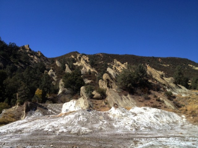
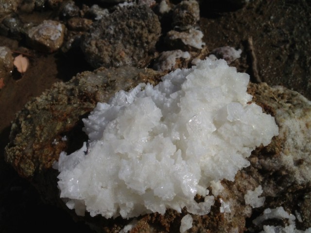
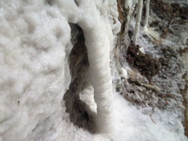
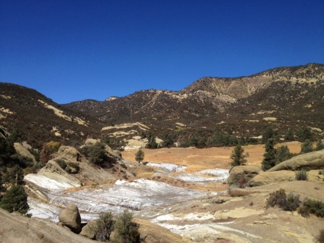
 The place. Note the white mineral deposit on its far side.
 A dribble of resin oozing from the leaf bud of a black cottonwood tree (Populus trichocarpa) growing along the Santa Ynez River.
 A bud post-pop, the leaves sticky and redolent of the fragrant resin.
 Ooey gooey fragrant bud resin.
 Goatfell Peak by silhouette from Brodick Bay.
 A view of Brodick Bay from the stony trail up to Goatfell Peak.
 Goatfell summit looking across at Cir Mhor or the “Great Comb.” (Properly pronounced
 Blasted by a piercing wind, jacket and pants inflated and puffy, we admire a wee wrinkle of hills.
 Micah and Chloe, center-frame, walking downhill on the hillwalk down from Goatfell Peak. Micah is the frontman for the popular band,
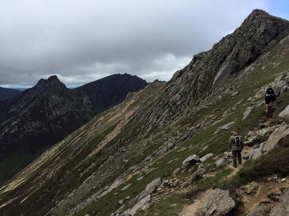
 Looking over the course of the trail from just below Goatfell Summit. The trail weaves through the boulders and on along the ridgeline, up the lesser peaks and down into the saddles between. Then down to a final saddle at the foot of Cir Mhor before dropping into the top of Glen Rosa.
 A view of Glen Rosa below.

 Having descended from Goatfell to the bottomlands of Glen Rosa with trout in the stream.


 A hankering had taken hold of my mind since the first fall of recent rains and I desperately needed to get out into the wet hills. I turned off the pass and onto a byway only to then abort the idea, and turn around and continue on down the highway to somewhere else, yet still not sure exactly where I was headed.
 Looking up at Ranger Peak.
 Light showers began drizzling from the clouds shortly before I reached the top of the peak. The sight and sound of falling rain, the rich fragrances wafting from a wetted earth, wild herbs, grasses and scrub and the moody ambiance of a cloudy winter day on Figueroa Mountain. After four years of record drought, a hike through water falling from the sky was a gloriously sensual and invigorating experience.
 Trail through the trees.
 The view from Ranger Peak looking into the San Rafael Wilderness backcountry.


