
 Zaca Peak left of center, as seen from Figueroa Mountain on June 14, 1937. (credit: J.E. Patterson)
“As a result of his 1903 visit to California, Roosevelt was to create the Santa Barbara National Forest out of the Pine Mountain and Zaca Lake Forest Reserves. This was the land that McKinley had set aside on March 2, 1898. … later known as Los Padres National Forest.”
—Walker A. Tompkins, The Yankee Barbarenos
The following article appeared in the Los Angeles Herald newspaper on September 25, 1898. It announces the establishment of the Pine Mountain and Zaca Lake Forest Reserve, which took place on March 2, 1898 by presidential proclamation. The new forest reserve stretched through Santa Barbara and Ventura Counties in California. It established what was, in part, the beginning of what today is known as the Los Padres National Forest.
President McKinley established the Pine Mountain and Zaca Lake Forest Reserve under the Forest Reserve Act of 1891, which allowed presidents to set aside protected tracts of land by proclamation. The mention in the L.A. Herald of the reserve being a “gift of Congress” was apparently erroneous or meant indirectly.
On December 22, 1903, the Pine Mountain and Zaca Lake Forest Reserve was combined with the Santa Ynez Forest Reserve (est. October 2, 1899) to create the Santa Barbara Forest Reserve. Over the next sixteen years, additional acreage taken from the existing reserves of Monterey, Pinnacles, San Gabriel, San Luis Obispo and San Luis was added to the Santa Barbara tract. The land was subsequently reclassified as a national forest, and on December 3, 1936, Santa Barbara National Forest was renamed the Los Padres National Forest by the executive order of President Franklin D. Roosevelt.
As conveyed in the article, such forest reserves were originally set aside with an emphasis on protecting crucial mountain watersheds in order to provide water for agriculture and human consumption. The reserves were intended to protect native flora, but only in so far as it was necessary to maintain the quality and availability of water. Certain passages in the story make it clear that the protection of native fauna was not a priority.
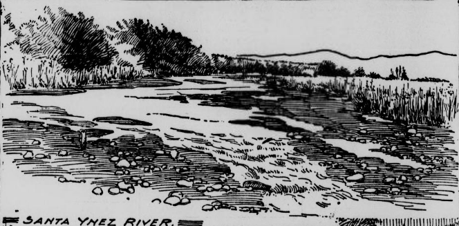
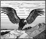
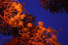
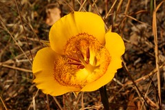
The black and white illustrations are original to the article as published, while the leading black and white photograph above, and the other color photographs, it should be obvious, have been added.
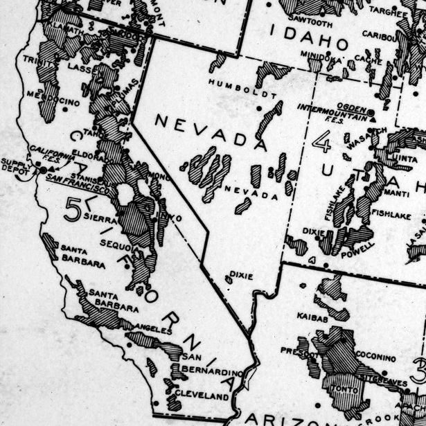 A U.S. Forest Service map from 1933 showing the Santa Barbara Forest.
THE NEW FOREST RESERVATION
Pine Mountain, Containing 1,666,000 Acres, Gift of Congress
to Southern California-Enormous Possibilities of the
Area—Importance of Forest Protection
Information is timely regarding that most recent and generous gift of congress to California, and Santa Barbara and Ventura counties. In particular, Pine mountain reservation, covering 1,666,000 acres.
So large is the area, and so wildly rugged, that the government found two
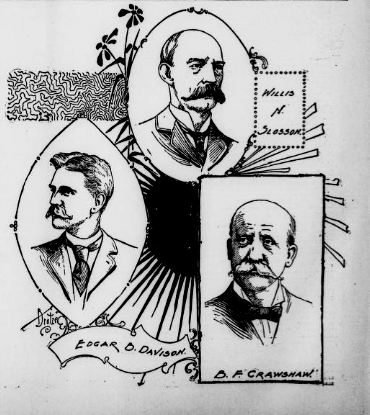
commissioners necessary: B. F. Crawshaw for Santa Barbara county and W. N. Slosson for Ventura county.
Originally Edgar B. Davison, H. H. Doyle (the present county clerk of Santa
Barbara county), Henry Robinson (editor of the Santa Ynez Argus), Mrs. Flora Haines Loughead and others suggested to Congressman McLachlan that Zaca lake and a few sections adjacent be set aside as a government reservation. Mr. McLachlan fathered the idea at Washington. Nothing further was done until Mr. Doyle formulated a petition
and Mrs. Loughead and others circulated it, obtaining many signatures. Thus revived, Mr. McLachlan’s successor, C. A. Barlow, took hold and amplified the bill to cover most of the mountainous part of Santa Barbara and Ventura counties—all in deed not hitherto preempted and settled. Mr. Barlow succeeded in pushing the measure to a successful goal and it became law de facto. Before this the magnificent pine forests were being rapidly destroyed. Mr. Davison’s articles in the country press had great influence in forming public opinion to be ready to support the petition.
Thus Pine mountain park was born. It is truly a magnificent reservation. The writer, listening in love of nature to her various language, has in past days often heard her curse the vandals who fired her forests, ranged stock over the uplands to the destruction of young tree growths, and stretched barbed-wire fences over miles of territory to restrain the public from travel.
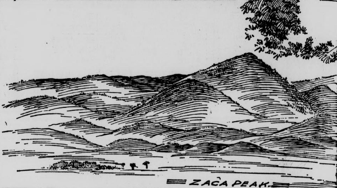
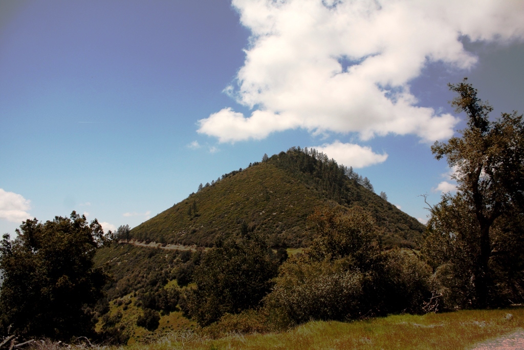 Zaca Peak
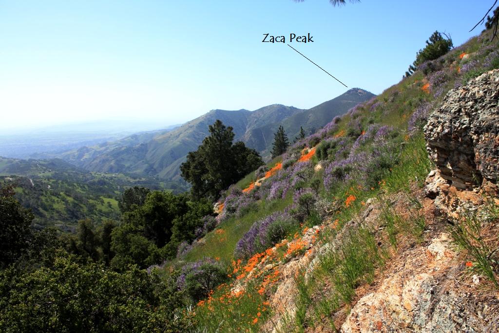
I have stood in the valleys and seen Zaca peak, visible for forty miles, one vast blazing torch, lighting the big Santa Ynez valley the night through. It was an awful and a glorious sight, but saddening to the soul. Other peaks, indeed the whole range of pine-clad mountains, have similarly lit the night in that region and left but desolation behind. Yet miles and miles of untouched forest remain, and under government care will bless the slopes of the San Rafael and Santa Ynez mountains, preserving the priceless heritage of their bountiful watersheds to the valleys of Santa Barbara and Ventura counties.
In one thing this reservation is unique. From any of its high peaks, as San Rafael (4400 feet), for instance, one can turn from gazing eastward over a wilderness of stupendous crags and abysmal canyons and view the “Balboan sea.” Away to the northwest, across the intervening valleys of the Santa Ynez, Los Alamos, Santa Maria and others, Port Harford is visible, and beyond it cold ocean, blue-gray on the horizon. Thence southerly, down the coast to Point Conception, Lompoc, Gaviota landing, Santa Barbara (city) and below Ventura to the headlands on the Los Angeles county shores. All this lateral scenery. In the foreview loom the channel islands. From that high point the geological contention that these islands are but submerged spurs of the Coast Range mountains is easily realized.
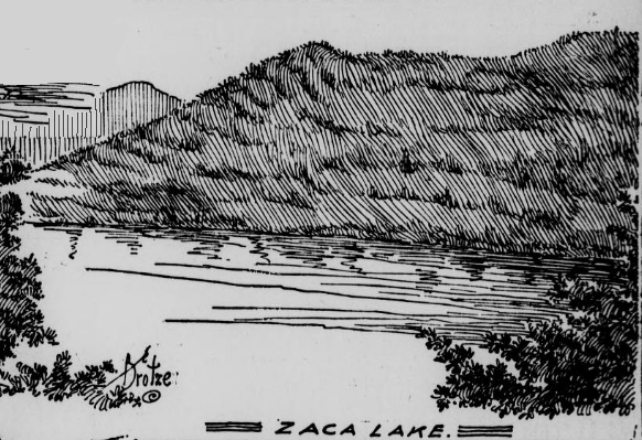
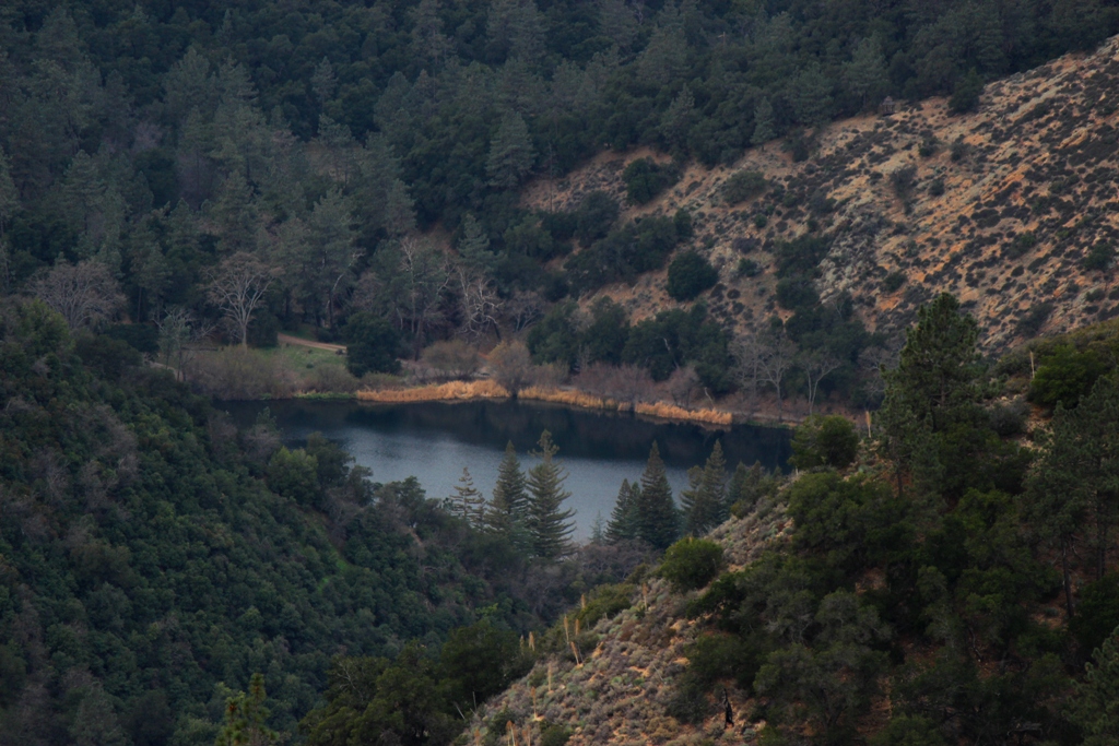 Zaca Lake
In the spring these slopes and precipices are the Golden State’s own vernal glory. Change the view point to Zaca peak. Right at one’s feet seems to lie Zaca lake, as lovely a stretch of water as the California mountains hold. Away down, 1500 feet below the spectator, it lies, like a sapphire or dew-drop amidst the pines. The lake is not large, but the judicious expenditure of a couple of thousands of dollars on the cracks in the strata in the lower end of what is termed “the sink” would make it a body of water a mile and a half long, half or three quarters of a mile wide and perhaps one hundred and twenty feet deep. It now covers thirty acres, eighty feet deep. Such a body of water, apart from its being henceforth a popular resort for many hundreds of visitors, would be a natural reservoir whereby the five hundred square miles area of the Santa Ynez valley would be made to blossom as the rose. The lake, even now, undeveloped, is always overflowing into a small stream which runs some twelve miles down the canyon; and this, too, after our long season of drought.
 Colonel Crawshaw, who has just returned from his first visit to the reserve and the lake, says truly that the park is one of the grandest scenic portions of this state, and compares it to the scenery of Switzerland. If the government will furnish a sufficient force of rangers, Commissioner Crawshaw will see that the reserve is protected from fires and depredators.
The reserve is an aggregation of terrific canyons, separated by unscalable mountain walls, and communicating with each other only at such long intervals as to make it a day’s journey, or even longer, to go from one to another. Such are the Manzana, Cachuma, Santa Cruz, Santa Ynez headwaters, etc. There are five of these vast gorges in Santa Barbara county and others in Ventura. A ranger is absolutely necessary for each of these larger canyons, in order to properly protect the watersheds from forest denudation by fire, stock rangers and wanton timber cutters.
No more excellent hunts of big game, such as mountain lion, bear, deer and like animals are to be found than these grand chasms. Lovers of nature can find in the remaining forests, and in the new forests the protected future will mature, more true recreation, better hunting and fishing, than elsewhere in the state, perhaps excepting the ranges of Northern California and those near the Nevada line. And this is all within forty or fifty miles of Santa Barbara city. Only this month George Owen killed seven big mountain lions on the reservation.
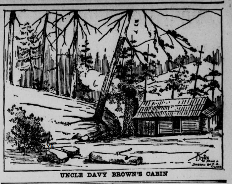
“Uncle Davy” Brown’s cabin, in the Manzana canyon, is one of the few traces of human life as yet to be found. Brown lived in that lonely gorge, twenty miles from anybody, nature’s child, and but little less rugged than his surroundings, for thirty years. He was 95 years old when at last he sought the valleys for care in his old age and at his death, which took place this year. Gentle as a woman, notwithstanding his ruggedness, kindly welcoming all freely to his home, “Uncle Davy” was a character loved by all who knew him.
The Hon. Benjamin F. Crawshaw, the first commissioner for the Santa Barbara district is a Pennsylvanian. He is an old newspaper man and an experienced official in the Interior department, having been there for twelve years. He has been a resident of the city of Washington for the past eighteen years. He is a lawyer, and has been admitted to practice before the United States supreme court. He is also an Odd Fellow of high degree, and in 1892-3 was grand master of the District of Columbia.
For the eastern half of the reservation Hon. Willis N. Slosson is commissioner. Mr. Slosson is a native of New York. In the fall of 1871 he moved to Kansas and eight years afterward to Michigan. He was a member of the Michigan legislature in 1889, and deputy collector of internal revenue under the Harrison administration, and sergeant-at-arms of the Michigan senate in 1895. He is a Knight Templar and thirty-second degree Mason. His headquarters are at Nordhoff, Ventura county [known today as the town of Ojai].
Edgar B. Davison, who has done as much as anyone else to procure the reserve for Californians, is a young man, a resident of Ballard, near the reserve. He is 29 years old, and has lived near or on the tract for fifteen years past. Pleasing to state is the fact that his zealous efforts to secure the state a splendid reserve have not been unrecognized at headquarters. Mr. Davison is now one of Commissioner Crawshaw’s assistants, and has his headquarters in Brown’s cabin, on the Little Manzana.
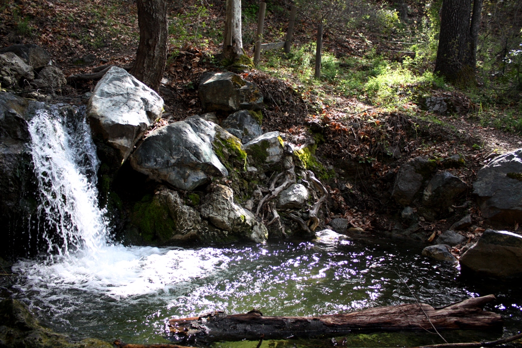 A pool on “the Little Manzana” or what is today known as Davy Brown Creek.
As showing how desperately necessary it has become for the government to use the most stringent measures, especially against fire-setters, on these reservations, the following is conclusive:
A dozen years ago water was abundant at definite levels in all wells throughout the Santa Ynez valley. The Santa Ynez river, rising in the reservation, ran 3000 inches in November. Today, vast fires having raged in the forests every year since, all wells have to be sunk ten feet deeper to reach water at all, and more feet to strike abundance, while the river is a mere brook long before November days bring lowest water.
Restoring the forests will bring again the old conditions, when, a hundred years ago, the old mission padres and their Indians tilled a valley full of streams and of forests. Today it is, by comparison, almost a desert. Plant the pines again; the spruce, the fir—which all grew there. Plant, fort low growths, the pepper, which thrives amazingly in those hills. Severe though the penalty for fire-setting be, it is not enough. A five-thousand-dollar fine sounds big. Irresponsibles who wantonly destroy forests are never able to pay a tenth part of that sum. Alternative punishment is only two years in prison. To many this sentence has small terror. I would suggest that those two years be put in by the criminal who, by carelessness, will fire a forest, at replanting the area ravaged, under guard of United States troops, a body of whom might well be on every reservation, subject to the rangers’ needs for extinguishing fires. Our forests are our wealth, more so than our mines, for agriculture is impossible without water, and water is not where forests are gone.
F. S. OLIVER.
Santa Barbara, September 22d.
Related Posts:
The Storied Life of Davy Brown
John Muir Writes of Davy Brown
Camping out in California: Pine Mountain Narrative (1887)
Reference:
The National Forests of the United States (PDF), The Forest History Society

















 Jack Elliott's Santa Barbara Adventure