
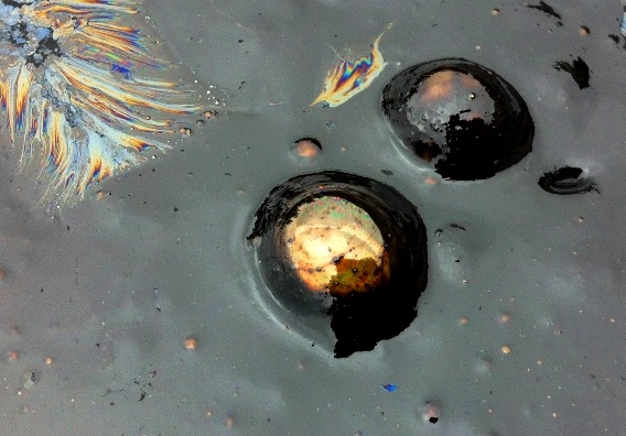
Crude oil actively bubbling out of the ground at the beach in Carpinteria, California in Santa Barbara County. Three offshore oil derricks are visible as dots in the distance.
“The surface of the sea, which was perfectly smooth and tranquil, was covered with a thick, slimy substance . . . the light breeze, which came principally from the shore, brought with it a strong smell of tar, or some such resinous substance. The next morning the sea had the appearance of dissolved tar floating on its surface, which covered the sea in all directions within the limits of our view.”
—George Vancouver, Captain Cook’s navigator, describing naturally occurring oil seeps in the Santa Barbara Channel (1792)
“Literature reviews of marine hydrocarbon seepage usually conclude that the area along the northern Santa Barbara Channel is one of the most prolific hydrocarbon seepage areas in the world.”
—Journal of Geophysical Research, “The world’s most spectacular marine hydrocarbon seeps (Coal Oil Point, Santa Barbara Channel, California)” (1999)
“The waters of the Santa Barbara Channel form one of the most biologically productive ecosystems found on earth.”
—Santa Barbara Channelkeeper
“The Santa Barbara Channel contains some of the most biologically diverse waters on the planet. Within these waters is the Channel Islands National Marine Sanctuary, which is host to the densest seasonal population of blue whales in the world.”
—United States Coast Guard
The Pacific waters of the Santa Barbara Channel hold several remarkable distinctions among all the world’s oceans. They are home to an abundance and variety of marine life rivaled by few other stretches of ocean on the planet, while also containing some of the largest natural oil and gas seeps in the world.
Fractured seafloor off Coal Oil Point in Santa Barbara County oozes about 4200 gallons of oil into the ocean every day or what amounts to the spill equivalent of one Exxon Valdez every five to seven years. The surface of the sea resembles a roiling boil of fizzing bubbles above some of the submarine vents and the iridescent sheen of crude oil covers vast swaths of the sea’s surface at times.
Scientists at University of California, Santa Barbara estimate that the natural seeps emit twice the amount of air pollution as “all the on-road vehicle traffic in the the county.” Due to this natural phenomenon, Santa Barbara County has thus far found it impossible to meet Environmental Protection Agency clean air standards. Over half of the tar that washes up on Los Angeles County beaches some eighty miles to the south originates from Santa Barbara County seeps. Studies suggest that at least 80 million to 800 million gallons of oil has been spread across the seafloor and buried in the sediment surrounding the seeps and outlying areas.
The seepage historically, however, has been far greater. In 2010, UCSB scientists announced the discovery of extinct 40,000 year old asphalt volcanoes 10 miles off the Santa Barbara coast. “They’re larger than a football-field-long and as tall as a six-story building,” geoscientist David Valentine said. “They’re massive features, and are made completely out of asphalt,” he said.
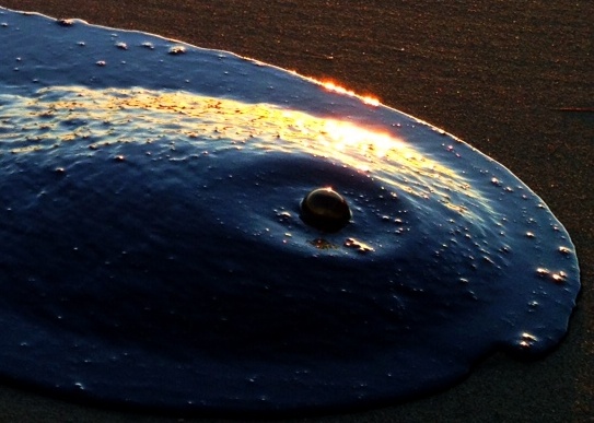
 Gas bubbling through natural seep oil on the beach in Santa Barbara County.
Oil is a biological product and is therefore biodegradable. Millions of years ago, the Channel was shrouded in a verdant tangle of plant life rather than immersed beneath a briny expanse of water. While earthly forces slowly turned once living plant matter into oil certain microorganisms evolved to make use of it. These single-celled organisms grew into voracious oil eaters. Today they thrive on the seepage greatly reducing the amount of it in local waters.
In 2008, Valentine and fellow researchers discovered that these microbes devour far more of the compounds in oil than previously known. “They ate around 1,000 of the 1,500 compounds we could trace, and presumably are eating many more,” he said. Much of what is left of the oil afterward eventually falls to the seafloor. A subsequent study analyzing seafloor sediment provided a glimpse at just how significant an impact the microbes have. “It’s dramatic how much the oil loses in this life cycle,” Christopher Reddy said, a marine chemist and colleague of Valentine. “It’s almost like someone who has lost 400 pounds,” he said.
Another study published in the Journal of Geophysical Research notes that not only is there active life around the seep sites, but there are actually more organisms than areas where no seepage occurs:
“There is a well-developed community of bottom-dwelling marine organisms in the sediments associated with the seeps at Coal Oil Point. Comparison of the benthic fauna at an 0il seep with the fauna in an area free of seepage showed that there are higher densities of individual organisms near the seep.”
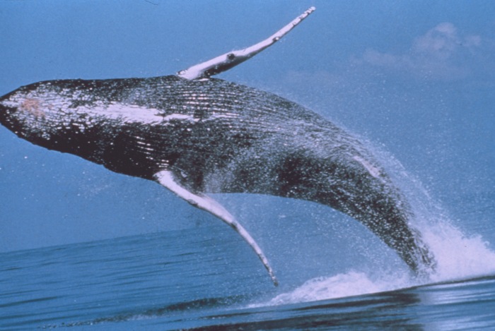
 Humpback whales pass through the Santa Barbara Channel between May and August. (c) NOAA
 Forest of giant kelp in the Channel Islands National Marine Sanctuary. (c)Claire Fackler, NOAA
Meanwhile, as voluminous amounts of oil drain into the ocean marine life thrives. A combination of natural features and phenomena like ocean currents, wind patterns and submarine canyons create a region of exceptional habitat. A wealth of marine life flourishes from plankton to blue whales, which return to the Santa Barbara Channel seasonally in greater numbers than anywhere else on earth.
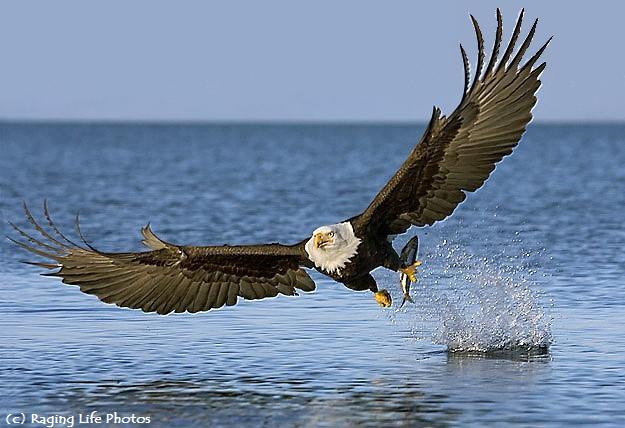
No less than 27 species of whales, dolphins or porpoises have been spotted and a handful of different types of seals and sea lions breed on the Channel Islands and mainland shore. The islands are home to over 150 endemic species and have been called the “North American Galapagos.” Thereon eleven species of seabirds occupy important nesting sites including bald eagles. A cornucopia of other smaller wildlife inhabits the region, too, many of which despite their relatively puny size are no less spectacular.
“If in any country a forest was destroyed I do not believe nearly so many species of animals would perish as would here from the destruction of the kelp.” –Charles Darwin 1834
Darwin, writing of the Galapagos, captures in one sentence the essential role kelp plays in the marine environment. An extraordinary sight in and of themselves, kelp forests provide critical habitat and food for well over 800 creatures in the Pacific waters of California from tiny organisms to large game fish and mammals. Kelp forests hold one of the greatest concentrations of biodiversity in all the world’s oceans and support one quarter of native marine life in local waters.
These forests of giant brown algae grow around the islands, along the mainland coast and, despite the abundance of oil, near Coal Oil Point. “In the shallow seep areas,” a UCSB study notes, “the bottom consists mostly of shale outcrops with rubble and sand and supports extensive beds of kelp.” Giant kelp is one of the fastest growing organisms in the world and can grow three feet in a single day. One of the more noted animals found among the kelp are southern sea otters.
Historically Coal Oil Point, one of the oiliest areas of sea in existence, was prime otter territory prior to their removal and relocation under the “no-otter zone” implemented in 1987 (a government policy officially abandoned in 2012). In 2008, a raft of about 30 otters appeared at the point in a seasonal push to expand their range, says Michael Harris, an environmental scientist with the California Department of Fish and Wildlife. They did not, however, return in following years, although one continued to be observed.
“If otters are allowed to,” Harris says, “they will eventually reoccupy and live in that area where there is natural seep.” Otters rely entirely on their thick fur for insulation because they have no blubber and a small tar blob caught in it can be lethal. Yet, Harris deals with just a handful of southern sea otters washing ashore annually which may be the result of natural seep oil. Presumably there would be more oiled otters if they returned to Coal Oil Point, yet return they will, Harris says.
The same environment that sustains such wondrous amounts of marine life also works wonders to reduce and dissipate massive amounts of crude oil therein. Various functions work to degrade and break it down thus lessening its impact on wildlife. Some of the oil evaporates when it surfaces or photo-degrades in sunlight, while the expansive Pacific itself disperses what remains and microscopic organisms feed upon it. Despite the abundant natural hydrocarbon seeps, the Santa Barbara Channel supports prolific marine ecosystems of immeasurable value that are home to iconic wildlife like few other places on earth. The region is a national natural treasure. Sometimes, oil and animals do mix.
 Southern sea otter and nursing pup.
 The California state fish, garibaldi, surrounded by sea urchins in the Channel Islands National Marine Sanctuary. (c)Claire Fackler, NOAA
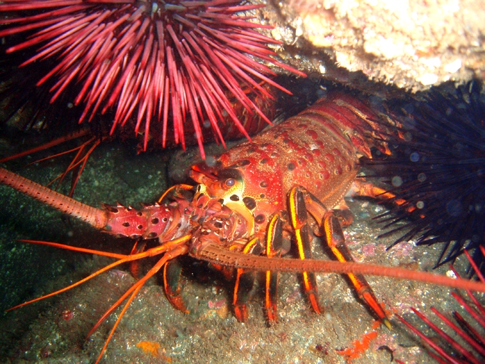
 A spiny lobster and sea urchins in the Channel Islands National Marine Sanctuary. (c)Claire Fackler, NOAA

Reference:
University of California, Santa Barbara Hydrocarbon Seep Project Website
Journal of Geophysical Research, “The world’s most spectacular marine hydrocarbon seeps (Coal Oil Point, Santa Barbara Channel, California)” (1999) (PDF)
University of California, Santa Barbara Geology Department Website
National Park Service, Channel Islands Website
Exclusive interview of Mike Harris, Environmental Scientist, California Department of Fish and Wildlife
Related Posts:
Oil Seeps at Carpinteria, California
Sulfur Mountain Oil Seeps, Ventura County
Great White Shark at Rincon
Spearfishing, 48 Pound White Seabass
Freediving For Spiny Lobster
19 Inch Halibut
27 Inch Halibut

 Santa Barbara backcountry
 Prickly phlox (Leptodactylon californicum) was abloom.
  The view up Indian Canyon as seen from Meadow Camp.
 Indian Canyon Camp lies under the oaks in a grassy field above the creek. From there the trail ends and it’s into the creek upstream any which way you want.
 Stillman
 The upper pool of the lower falls, as seen in June 2010.
 Same pool as seen in April 2013. Note the absence of sediment, the difference in water volume over the falls in this drier year, as well as the tall green tree behind Stillman, which in the photo from 2010 is no more than a small sprout barely visible in the shadows.


 Stillman taking a gander at a narrow spot in the canyon.
 The Perfect 10
 Looking downstream through the narrows of Indian Creek.
 Looking upstream at the narrows.
 The ubiquitous fire scorched skeletons of chaparral.


 Several pools along a tributary of Sespe Creek.


