This post is second in a series. Read the first here: The Carrizo Experience: Ten Hours on the Plain I: Ruminants on the Range.
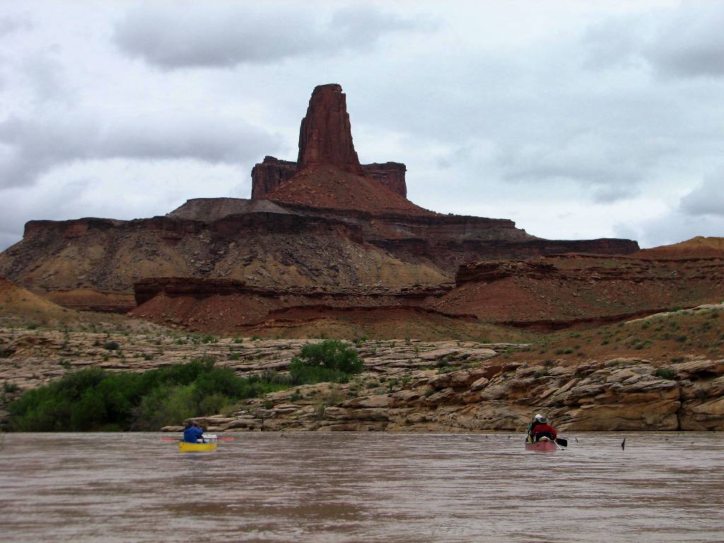
 Selby Rocks as seen from the Caliente Range, Selby Campground on the left at the foot of the hill.
The Bedrock Mortars of Selby Rocks
The silence hit me again when I stepped from my rig. It filled my head with its low hum, as my ears strained to hear what was not there. The ticking of my hot truck engine was the only sound. I stood on the Caliente Range peering over the tops of juniper and scrub brush, and down onto the isolated plain far below devoid of the hordes of hurried humanity left behind for the day. I had seen more pronghorn antelope than humans so far.
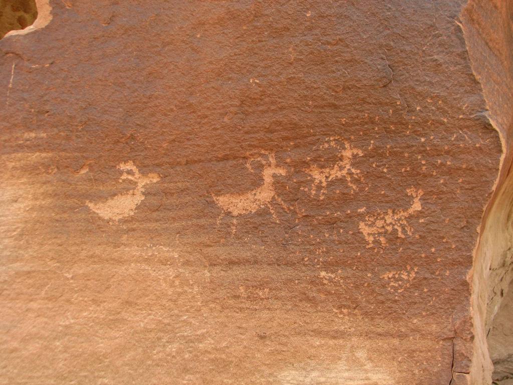
Back down on the plain standing perched atop the Selby Rocks I could see mortars of all sizes and ages riddling the bedrock around me. Some were relatively new looking while others were so weathered and eroded and thickly covered in lichen that they were barely discernible. Archaeologists estimate that the earliest inhabitants of the area arrived during the Paleoindian period circa 11,000 to 9,000 B.C. How ever old the bedrock mortars are, it’s evident that long ago a significant amount of labor was carried out here grinding seeds.
It brought to mind what I imagined might have been a typical scene carried out hundreds or thousands of years ago. The murmur of an indecipherable native language spoken by women hunched over bedrock millstones grinding away. The constant scrape of sandstone pestles in mortars and the air tinged with the acrid scent of wood smoke from smoldering campfires. The throaty squawk of ravens circling overhead punctuated the silence as I stood lost in thought.
I moseyed up the nearby seasonal creek, which runs through a gap between massive chunks of bedrock, and passed through its short needle-eye narrows. With little rain this season, the sandy ditch was merely damp in places and covered in the low green growth of this year’s annual grasses. Above and beside the creek, adjacent the narrows, the soil-level bedrock formation is pitted with even more mortars. Many of them are filled with dirt, perhaps there are yet still more buried out of sight.
As I left the area and walked back to my truck I pondered the difference between the Selby Rocks site and nearby Painted Rock. Some faint traces of pictographs still stain the more protected niches of the Selby Rocks, but nothing remotely close in size or scope compared to Painted Rock. The former rock outcrop is dotted in clusters of mortars with little rock art, while the latter is covered in paintings but has few millstones. I pulled the truck door closed, turned the key and with the roar of the engine headed down the road toward the prehistoric murals on Painted Rock.
 A section of the Selby Rocks with deep, highly eroded mortars.
 A closeup of the large mortar seen in the previous photo near the grass. It measures about 10 to 12 inches deep.
 There are at least seven mortars in this photo all in various stages of disappearance due to the elements. Some have nearly vanished entirely.

 A view showing how the mortars were started in the natural depressions atop the outcrop, which appear to have been worn into the stone over the centuries by sitting water during the rainy season. Compare these smaller mortars, which measure just a couple of inches in diameter, to the larger ones in the previous photo. Note also how once created the mortars somehow erode more slowly than the rest of the surrounding stone and so eventually seem to rise out of the natural depression.
 A group of highly eroded and lichen covered mortars. I was able to discern no less than ten mortars in this frame when I snapped the shot.
 Selby creek or what is better described as a seasonal drainage ditch.

 The narrows.
 The exposed bedrock here is riddled with smaller mortars. At least six are visible in this photo. The creek runs through the rocks on the right and about 25 feet from where this photo was taken.
Related Posts:
Cave’s Eye View on the Carrizo — Summertime Soda Lake — Selby Rocks — Carrizo Plain Wildflowers — Wallace Creek Offset, San Andreas Fault — Soda Lake Winter Reflections — Elkhorn Plain — Dragon’s Back Ridge, San Andreas Fault

 Anthopleura elegantissima
 Bibliography:


 Clint Elliott hanging five.
 Ancient ruins.


