
 The Gaviota Coast and Santa Ynez Mountains.
“The Gaviota Coast is the largest stretch of undeveloped coastline remaining in Southern California, and is representative of the only coastal Mediterranean ecosystem in North America.”
—Gaviota Coast Conservancy
Surf in the morning. Spearfish into midday. Hike the afternoon away. Ah yes, the beauty and bounty of the Gaviota Coast.
The Gaviota Coast is an especial place. It is remarkable for its rich marine and terrestrial biodiversity, desolate beaches, surf, rocky mountains and the rarity of a prodigious stretch of undeveloped California coastline.
Aside from my affinity for such exceptional characteristics it is a place of particular sentimental value to me. I lived for awhile in a canyon along the Gaviota Coast as a kid and spent much time exploring the beaches and mountains unsupervised by adults.
During this time I developed a close connection to the area that would grow, as I later spent time working at several different residences and ranch properties along this stretch of rural coastline, as well as at exclusive homes in Hollister Ranch. Even in my menial duties on remote $15 million estates the bucolic beauty of my surroundings never escaped me nor lost its luster.
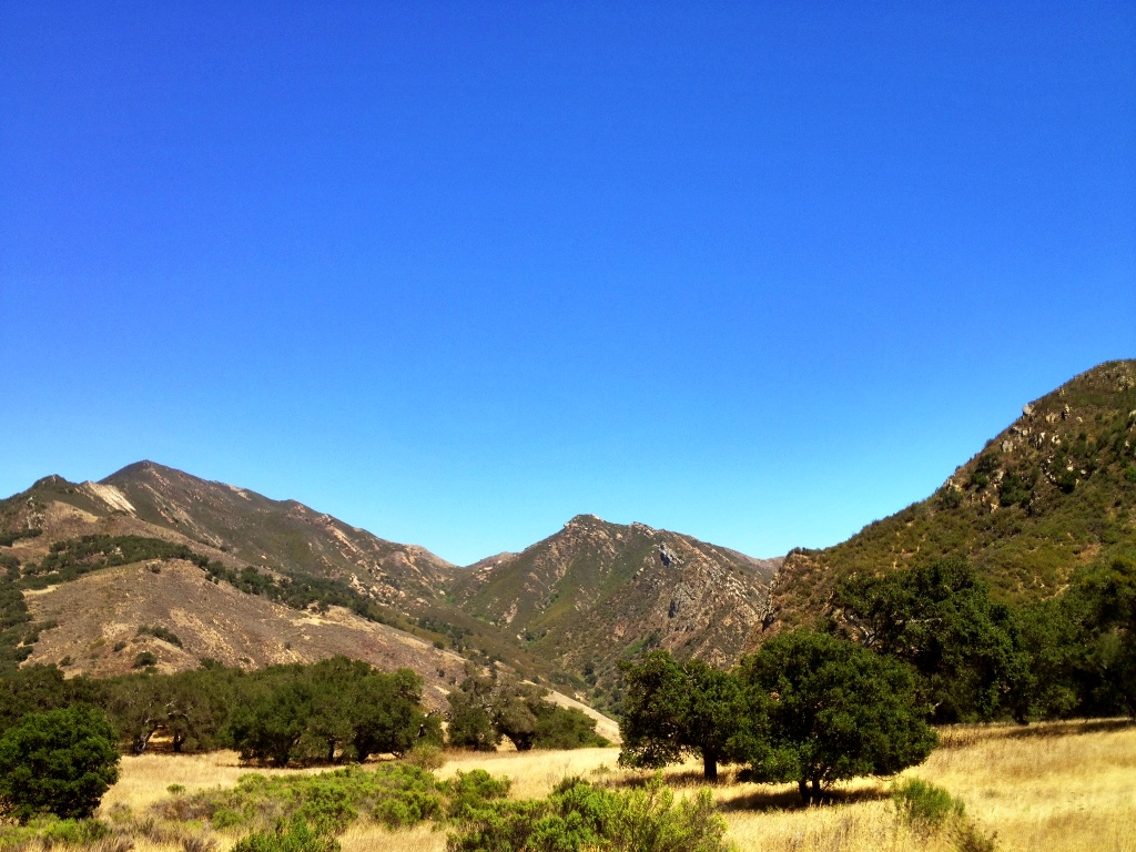
 The mounded peak overhead in the distance is the objective, overlook point.
 The westward pointing finger of the southern Los Padres National Forest.
One of the many beauties of the Gaviota Coast are the Santa Ynez Mountains. The crest of this coastal range forms a westward pointing finger of the Los Padres National Forest (LPNF) reaching Gaviota State Park, which makes it possible to access the forest on foot by way of trail from the sandy wet seashore at the park. Such beach to backcountry trail access into the LPNF is possible nowhere else in Santa Barbara County.
The Beach to Backcountry Trail in Gaviota State Park leads passed the Wind Caves and a short side branch of the trail leads to a prominence overlooking Gaviota Pass.

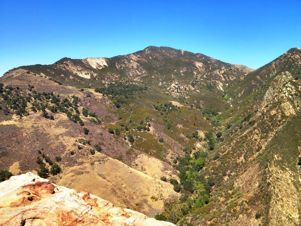
 Gaviota Peak on the left and the overlook mountain on far right.
 A view from the trail.
 A view of Gaviota Peak from Gaviota Pass overlook.
 Highway 101, Gaviota State Park beneath the railroad trestle and the Pacific Ocean.
Related Posts:
Gaviota Pass and U.S. Route 101 (1930s)
Motoring on the Gaviota Coast (1906)


Fantastic read. The pictures are incredible. Everything about the USA fascinates me, despite never having actually lived there, nor ever having had chance to visit (yet).
We always used to play out unsupervised and go off across our moorlands and through our woods – shame no-one does nowadays! (well, they don’t here anyway)…
Stunning photos – it looks a lovely area,
Carol.
“shame no-one does nowadays! (well, they don’t here anyway)…”
It’s largely the same on this side of the pond. Interestingly, your comment here could serve as a perfect summary for one major point made by an author named Richard Louv in his book, “Last Child in the Woods.” He discusses at length how children, for various reasons, do not play outside in nature as they once did. And he links this lack of time in the woods with some of today’s most pressing childhood disorders and problems.
“By the 1990s the radius around the home where children were allowed to roam on their own had shrunk to a ninth of what it had been in 1970. Today, average eight-year-olds are better able to identify cartoon characters than native species, such as beetles and oak trees, in their own community.”
Most of ours play indoors – the rest don’t leave the street – even on bicycles – can’t see the point of a bicycle for a few yards!
But I wrote a post on it myself last year – I’ll attach the link in case you want to have a read. You get to see pictures of my area too 🙂
Carol.
Like all your posts, this one is very interesting. I didn’t know that there were caves there, which look like they are not natural, but may have been Indian (Chumash) excavated. Any thoughts here? Steve
The one cave shown in this Gaviota post, which is really a tunnel, appears to be man-made to me just by its shape.
But in looking closely at it, I saw no markings, scars or bore holes in the sandstone that would indicate it was created by people.
I also scanned it closely for signs that the Chumash might of made and I saw none.
It is, however, very soft sandstone so any signs of the past may have easily just eroded away.
Interesting, as wind and rain patterns would have to have been rather strange to erode that cave in such a way. Thanks, Steve
Yeah, it would take quite a lot to hollow that out.
Thanks for your other comment, Steve. 60,000. . .wow. I had no idea about that.
By the way, thank you for your post about Veterans and the picture of the POW / MIA flag, as I’m a Vietnam Vet and lost 13 Santa Barbara friends from high school and City College. We ALL should remember their ultimate sacrifice. Steve
Indeed.
It’s the very, very least I could do. I view the world through a very large frame of reference and I do not take for granted all that I have inherited from those that came before me. Regardless of one’s particular opinions on war and politics, I feel we must honor those who risked and lost their lives serving their country.