 Sisquoc Falls, located in a restricted condor sanctuary in the San Rafael Wilderness, is officially off-limits to the general public.
The following narrative was originally published in the Santa Maria Times in 1884. It chronicles the bushwhacking exploratory adventure of a group of men who fought their way up Santa Barbara County’s remote, wild and trailless Sisquoc River to its headwaters and surrounding mountains.
Locals with experience hiking Santa Barbara County mountains, and who well know the brutally impenetrable and lacerative nature of chaparral, may find it humorous that the explorers warn readers, “we advise anyone undertaking the trip to take along a sheet-iron suit of clothes.”
Hiram Preserved Wheat, mentioned by last name in the story as a guide, was “the patriarch of the Sisquoc homestead community,” write Blakley and Barnette in their book, “Historical Overview of Los Padres National Forest” (1985). He was known to the pioneers of the Sisquoc River area as “Old Man Wheat” and originally came from Potawanie County, Kansas. Today, a grassy and steep, pyramidal mountain overlooking the Sisquoc River is named in his honor, “Wheat Peak.”
The other guide mentioned, Forrester, was another member of the Sisquoc homestead community, Edward Everett Forrester. He was one of three people chosen to form a board of trustees for the community’s newly constructed schoolhouse in 1893. (Manzana Creek Schoolhouse 1893)
 Wheat Peak, as seen from Manzana Schoolhouse, looms over the Sisquoc River which flows along its base.
The Sisquoc Falls: A Little Known Region in California Explored
Having heard so many conflicting reports about the wonderful scenery at the headwaters of the Sisquoc Creek, we, in company with Messrs. Wheat and Forrester, concluded to make a thorough exploration of that section, which has until lately been almost a terra incognita to even the oldest settlers, owing to the dense chaparral which covered the mountains on all sides, and made it almost inaccessible until an extensive fire swept over the several hundred square miles about there. We supplied ourselves with a necessary outfit, mainly blankets, Winchester rifle and salt, mounted the hurricane deck of our favorite caballo and the first day reached Mr. Wheat’s ranch, 35 miles from Santa Maria.
 The next day while passing through the narrows, where the canyon is only seventy-five feet wide, the walls above towering hundreds of feet, we met with a slight accident in the same place where two other horsemen had come to grief only a few days previous. On one side a trout pool ten or twelve feet deep, on the other a shelf of slippery soapstone, to cross at an angle of 45 degrees. My horse’s feet slipped, and first the rifle went clattering down the slope, horse and rider rolling after in inextricable confusion. The rifle went off, striking the horse, fortunately missing a vital part. A mile further on we reached Mr. Robert’s camp and were soon supplied with a remount.
After passing the narrows we had to cut a trail for miles until reaching the burned country above the main forks of the river. Ascending the south-east fork about twelve miles from the river we came to Ventura Fall—as we named it—from the great number of them about there. The gorge at the foot of the fall was wild and picturesque in the extreme. Huge boulders and fallen trees, with occasionally a cascade varying in height from ten to one hundred feet to climb around. Grizzly bear tracks were quite plenty, but no grizzlies came in sight on the top, nor were we hunting any.
We climbed above and measured the main fall and found it to be 480 feet in height—a sheer descent with about 30 miner’s inches of water flowing over it. The stream falls about 2,o00 feet in two miles and a half, making a great number of beautiful cascades. The pool below the fall is 80 feet long, 40 feet wide and upwards of thirty feet in depth, clear and cold as ice, and so sheltered by the overhanging bluffs that the sun rarely shines in it.
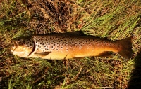
 Fishermen displaying their catch, or plunder depending on your perspective, along the Sisquoc River (1916). The waterway is now an officially designated Wild and Scenic River. Fishing is no longer legally allowed in an effort to protect native southern steelhead, which are an endangered species and cling to existence today at about one to two percent of their former population size.
Near the top of the bluff, and at an elevation of 4,000 feet above sea, is an old beach line about fifty feet thick of rocks and marine shells deeply cemented together. This is the fifth well defined beach line to be found at the various altitudes between this place and the summit at the San Rafael range, all of them showing a different age and different formation of rocks. We found marine shells, etc., in the sandstone at the extreme summit of the range, at an altitude of over 5,000 feet.
Climbing the mountain above the fall we found to be terrific work; the dense chaparral partly burned and partly grown up again, was impossible to get through without chopping for miles. Near the summit of the range, between the Sisquoc and the Santa Ynez, we found a belt of fine timber on the northern slope of the mountain, about three fourths of a mile long and half a mile wide. We made a thorough examination of the whole grove and found it to consist mostly of the yellow pine to be found at certain altitudes on all mountains in California. Quite a number of the finest kind of sugar pine, with a few scattering firs and cedars, the latter being mistaken for redwood by an experienced woodsman, with a few oaks intermingling. We made a partial count of the grove and estimated the number of trees fir for milling to be from 9,000 to 10,000, the majority of them being from three to five feet in diameter.
After a careful search, we could find none of the unmistakable traces which a white man leaves behind him and concluded that the place has been hitherto very rarely visited by them. In one place were three cedar stumps which had been cut at least from 50 to 75 years, judging from their state of decay. It was done with a dull ax by Indians, probably to make bows from.
 A clear, cold and deep pool along a tributary of the Sisquoc River.
The slope is so steep that we could find no place level enough to spread our blankets without shoveling, except at the extreme summit of the mountain. There we had a magnificent view of the whole surrounding country. To the south and west lay the Santa Barbara Islands. Far out across the Mohave Desert, upwards of 200 miles distant, the Providence Mountains were plainly seen. To the northwest the wide sweep of the San Joaquin Valley, on the further side the Sierra Nevadas, the snow-capped summit of Mt. Whitney and other lesser peaks, while in the northwest lay the coast range, a succession of sharp ridges and steep canyons, covered with dense chaparral for hundreds of miles, with here and there a beautiful valley nestling below.
The day was exceptionally clear, and the prospect well repaid us for all the trouble of getting there. The following day we tried to ascend the main south fork of the creek, which is even a rougher and wilder gorge than the other, if possible. After climbing a mile and half we came in sight of another fall from 250 to 300 feet high, considerable water flowing over it. We had to give it up as a bad job that day, and we advise anyone undertaking the trip to take along a sheet-iron suit of clothes.
Those falls are about 65 miles from Santa Maria, and the timber belt spoken of about 70 miles. On coming back to camp we found one of the party, Mr. Roberts, in chasing a wounded deer had broken a bone in his foot, compelling us to start out as soon as possible. In another branch of the creek we found a small grove of genuine sugar maples, some of them two feet in diameter, the only natural grove of the kind we ever heard of in California.



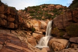
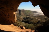





Sisquoc Falls was my destination in the spring 1966, but we never reached it. Fire danger had closed and locked a gate at Upper Oso Campground. The cliff at the falls is impressive to see in your photo of that area. A pair of Condors were reported to have once nested on that cliff. A remote and beautiful area. In recent years we drove to Upper Oso Campground again to see if it was as I remember. But it had been changed and no longer like the place I remember.
Dan Fenske
Harrisburg, Oregon
Hey Dan. Thanks for stopping by.
This is great Jack, very cool read. I descended South Fork last year from the top down and they were right about the suit of armor. I wonder if the dull axe cuts they saw up around Mission Pine were the remnants of cuts made from the construction of the Santa Barbara Mission. Thanks for sharing.
Hey Bryan. Yeah, those ax cuts had me wondering the same thing. Their estimation of when they were cut puts the date within range of when the missions were built. Pine timber from the area was purportedly also used in the construction of other missions.
And in Blakley’s and Barnette’s history they mention that there are stories about timber from the area being used in the building of the original Mission San Antonio, and they cite an anecdote from an elderly man that remembered seeing cedar timber used in that mission.
So it seems certainly within reason that those cedar stumps mentioned in the story could have been cut for the Mission, but I question why only three stumps? That’s not much timber to bring back from such a long haul. Perhaps the other stumps rotted, but then why did just three for some reason remain? I would think that quite a lot of trees would have been felled so there would have been far more than just a few stumps left.
Whatever the case I think it’s pretty clear that the trees weren’t used to make bows, heheh.
Thank you for another revelation,(for me).