Pit Viper On Arroyo Burro Trail

chumash bedrock mortarChumash bedrock mortars in Barger Canyon below Arroyo Burro Trail.

Arroyo Burro Trail purportedly follows an historic Chumash Indian route over the Santa Ynez Mountains linking the Santa Barbara coastal plain to the Santa Ynez Valley. In the foothills below the trail can be found a number of bedrock mortars, including in Barger Canyon and several in and around San Roque Canyon. It is, along with Jesusita Trail, one of the first hiking trails I explored as a kid.

clouds
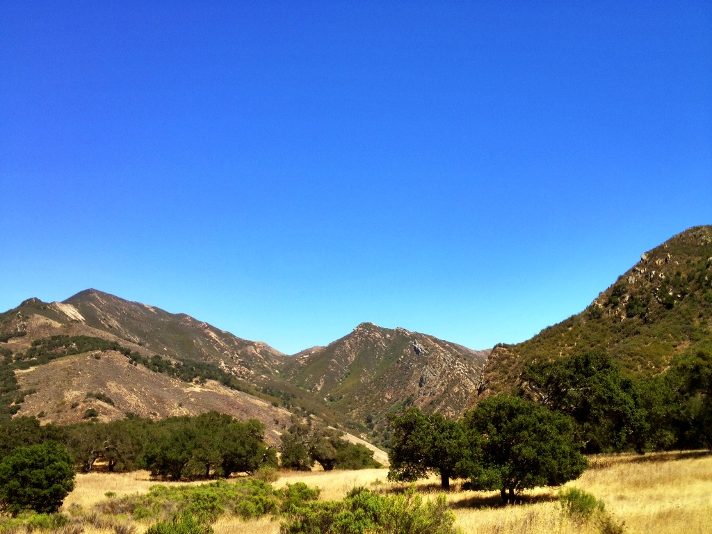
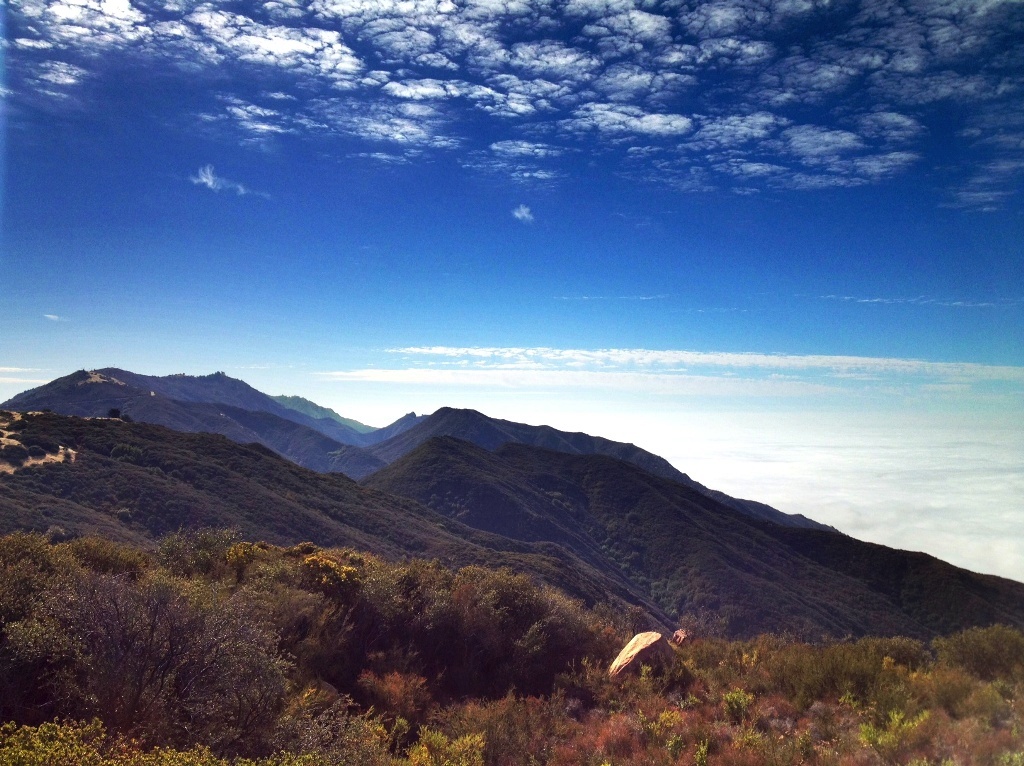
Clouds over Santa Ynez Mountains.

“If one has driven a car over many years, as I have, nearly all reactions have become automatic. One does not think about what to do. Nearly all the driving technique is deeply buried in a machine-like unconscious.”

—John Steinbeck Travels with Charlie In Search of America (1980)

Steinbeck describes in a simple, specific example a general universal experience. With enough practice many activities become second nature. It’s what author Laurence Gonzales has described as “automated (unthinking) action.”

In his book, Deep Survival, Gonzales discusses how the human mind develops “mental models” of the world based on personal experience, and how these models can unconsciously shape if not control one’s actions.

Mental models enable us to navigate through the complexity of daily life in an efficient manner, because we can act and complete tasks without having to waste time thinking about all the sophisticated intricacies involved in making them happen. In an article for National Geographic Adventure Gonzales echoes Steinbeck:

“Most people, for example, have a complex model for driving that allows them to do so while talking on the phone and drinking coffee. Once models are established, they require no thought. …This system uses our previous experience to prescribe our behavior in new situations.”

Arroyo Burro Trail
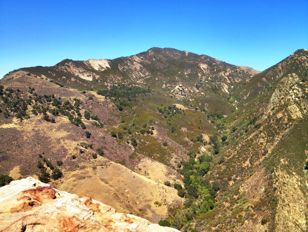
A view southeastward down the crest of the Santa Ynez Mountains overlooking east fork San Antonio Creek canyon through which Arroyo Burro Trail passes, a heavy marine layer covering Santa Barbara and Pacific Ocean below.

Whether driving a car or walking, as with with much else in life, the mind builds complex road maps allowing us to act automatically based on acquired knowledge from previous experiences. In an earlier post (Sage Hill to Santa Cruz Guard Station) I reflect on hiking in that context in response to the Steinbeck quote:

Along certain stretches of the thin winding dirt ribbon leading me to my destination, I seem to slip into a liminal realm between conscious states. I follow mindlessly the path before me. Walking on autopilot, a machine, I plod along the trail by rote as my mind flies through an abstract wilderness of thought and memory.

I didn’t know it at the time, but I’m describing what it’s like to act within the framework of a mental model. But while this quirk of the mind enables effortless ease of action it can also insidiously blind a person to danger and potential threats. While hiking the Arroyo Burro Trail recently I nearly stepped on a rattlesnake because I was mindlessly following the footpath on autopilot.

Arroyo Burro Trail Barger PeakTrail leading down into the canyon.

The section of singletrack trail I was hiking near the top of Arroyo Burro Trail is slightly overgrown with grass and scrub, and although the tread itself is a well-beaten wide furrow, it’s hard to see in some places as it disappears underneath the overhanging plants.

Yet even though the path isn’t too visible in certain spots, I was charging along looking around more at my surroundings than where exactly I was stepping. It was the march of an experienced hiker, of somebody, anybody, that’s walked away innumerable hours on mountain trails over the course of several decades.

I couldn’t always see where I was stepping, yet I wasn’t always looking and I hardly if at all slowed my pace. I was guided by a well-established mental model enabling automated unthinking action and taking for granted that my feet would fall on a trail I was hardly looking at.

Arroyo Burro Trail East Fork San Antonio Creek
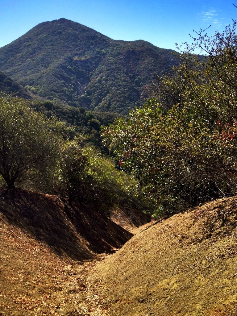
Upper San Antonio Creek canyon.

Arroyo Burro Trail south
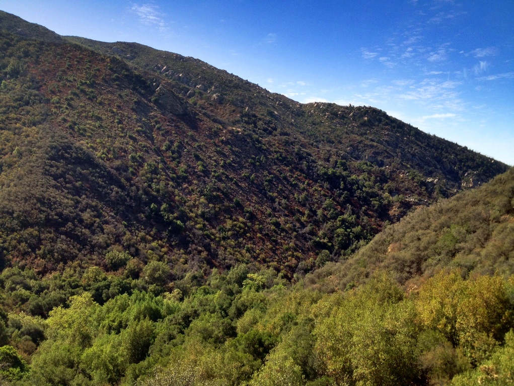
Trail towards the creek.

As I walked passed a clump of brush some creature bolted through the fallen leaves and tangle of dead branches causing gravel to slide down slope toward the creek. Whatever it was sounded big, but I quickly conclude it was probably a rabbit or some other small furry animal. I slowed my pace, but kept walking, looking for the animal as it loudly scurried away. The noise ceased then erupted again causing me to stop short and peer into the brush.

I didn’t see anything and without thinking, or looking where I was stepping, I resumed my march. I took a couple of light, short steps still looking toward the creek before glancing back around, and leaning into my walk with earnest strides, only to see myself plant a foot about twelve inches from the head of a pit viper lying across the trail.

For the rest of the afternoon I hiked far more slowly and nervously, afraid of stepping in every little spot obscured by shadows and brush, wondering if even on clear sections of trail there was a rattler hidden in the trailside weeds waiting to strike.

At one point I stepped on a dead branch half buried in dried leaves, which shifted in the mulch enough life a snake to make me physically jump. I felt a deeply ingrained fear shoot through my body for a split second and it actually felt like a snake squirming through my innards, somewhat similar to an electric shock where one can feel it enter a finger, for example, and exit some other part of the body. I had to take a deep breath to rid the terrible constricted feeling from my chest.

Rattlesnake Santa Ynez MountainsRattlesnake on the trail.

I had been paying attention to everything else but where I was stepping. Right in the midst of feeling totally in control in an activity I’ve done all my life, so much so that I don’t even have to focus on it, and I was jarred back to attention and ripped from a thoughtless complacency that nearly earned me a frightening trip to the hospital. The feeling of control was an illusion.

Most accidents are the result of human error. Many times it’s easy in hindsight to see where things went wrong and for what reasons. In Deep Survival, Gonzales writes about how mental models can sometimes lead to injury and death among even highly trained and experienced experts by triggering or enabling reflexive or automatic actions that, while having served well in past experience, override reason and common sense in current circumstances and lead to accidents.

As a result some things, some stimuli in the environment, factors in the grand equation of the moment that should demand attention, are overlooked or ignored and tragedy strikes. And it happens precisely when a person feels most confident and in control of a relatively simple or ordinary situation.

It’s beneficial to routinely slow down, pay deliberate attention and carefully observe one’s surroundings and allow time for second thoughts, because as Gonzales writes, “first thoughts are no thoughts at all. They’re automated actions.” It seems like obvious self-evident advice, but the human mind makes it remarkably easy to ignore. Don’t settle for seeing, but actively scrutinize the ordinary and know that experience and knowledge can provide a dangerous illusion of control and safety. Such deliberation may well save your life.

rattlesnake head

Posted in Santa Barbara County | Tagged , , , , , , , , , , | 6 Comments

California Condor; Timeline of Tragedy and Hope

California condor soaring
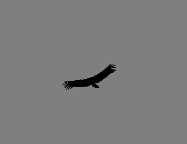
A California condor soaring over Sespe Wilderness.

1890California condor population estimated at 600.

California condor sunning wings spread1982Only 22 California condors alive in the world.

California condor1985A single breeding pair survive for the entire species.

California condor Santa Barbara Zoo1987The last wild condor is captured from Bitter Creek National Wildlife Refuge in Ventura County.

California condor head1992-2011Following restoration efforts and captive breeding 92 condors are released into the wild.

Santa Barbara Zoo California condor2013There are now about 404 California condors in the world with 235 flying free in the wild, 69 of them in southern California. (Friends of Condors)

Related Posts:

Condor in a Cage: Time Line of Tradegy | Condor Point |Condor Feather | Whiteacre Peak, Fossilized Bones, Cougar Prints and Condors | Desperate Fight with Condors: Narrow Escape of Santa Barbara Man (1899)

Posted in Santa Barbara | Tagged , , , , , , , , | 3 Comments

Corpse Flower (Amorphophallus Titanum)

Amorphophallus titanum corpse flower titan arumPost peak bloom, starting to wilt. It’s a fleeting display lasting only hours.

I went out to the University of California, Santa Barbara to see the corpse flower in bloom, a titan arum named “Chanel.” In the wild it’s a rare species which is endemic to western Sumatra, Indonesia, and it’s said to produce the largest inflorescence in the world.

Chanel, which reached a height of 4’10”, was grown from a seed harvested from the corpse flower named “Tiny” which bloomed at UCSB in 2002. When I saw Tiny in bloom at that time there was only a few other people there to take a gander.

That was before the advent of Facebook. This time a special Facebook page was set up to chronicle the bloom cycle of Chanel and it quickly racked up over one thousand “likes” and countless other followers. A webcam provided online viewers still photos taken every five minutes making it easy to know when exactly the plant was going to bloom and several thousand people turned out to take a looksee.

This time when I arrived there were about 70 to 80 people in line, while in 2002 there was no line. After being there forty-five minutes, as I walked out after seeing the famous plant, the line remained just as long. While only anecdotal, it’s interesting to see the apparent power of social media to get out the word about such an event and the crowd it’s able to rally.

The plant’s Latin name may be translated as meaning “giant misshapen penis.” Amorphos, meaning without form or misshapen; phallus meaning penis; titanum meaning giant. Watch a time lapse video of the plant blooming and it’s readily apparent why whomever named it chose that name.

I can’t help but wonder, however, why they chose to emphasize its phallic characteristics in a name rather than anything else about the plant like its putrid stench when in bloom, which is such a notable and essential feature of its existence.

Its rancid smell, which is emitted when the bloom opens and the spadix or large upright shaft heats up, helps attract insects to pollinate it. It lasts only a day or so. The temperature of Chanel near its peak bloom was measured at 95 degrees.

chanel corpse flower amorphophallus titanum

titan arum in habitatAmorphophallus titanum in habitat in 1925. (Tropenmuseum of the Royal Tropical Institute)

durian fruit photoHere I am in Indonesia just prior to tasting my first and last durian fruit. (Photo from 2001, and for anybody that may not recognize it, that’s not my head, it’s Chevy Chase.)

On a different somewhat related note, being intrigued by exotic plants as I am, in southeast Asia there is a fruit called durian. In 2001 I had the (dis)pleasure of sampling a nibble and nearly vomited. The fruit has a thick spiked skin, but its flesh is soft with a custard-like consistency similar to cherimoya.

Durian tastes okay, and I might have been able to get passed its mushy, slimy consistency were it not for the fruit’s gut turning disgusting stench. It reeks like a mixture of rotting excrement and diesel. It smells so bad that some hotels in Indonesia place signs prominently in their lobbies, as I saw, warning guests not to bring durian fruit into the building.

Despite this less than desirable characteristic the fruit is highly regarded among many locals and several men nearby who saw me gag on it were obviously amused. I had no problem giving it to them after I tried it, as they happily accepted it.

Related Posts:

Small Corpse Flower at El Capitan Beach

Stapelia Gigantea Bloom (carrion flower)

Miniature Stapelia Bloom

Posted in Santa Barbara | Tagged , , , , , , , , , | 1 Comment

Semen Stains, Fake Tequila and Cava de Oro in Mexico

Sonoran Desert MexicoSonoran Desert

“The traveler was active; he went strenuously in search of people, of adventure, or experience. The tourist is passive; he expects interesting things to happen to him. He goes ‘sightseeing.’”

Daniel J. Boorstin, The Image: A Guide to Pseudo Events in America (1961)

Through the eye withering, searing summer heat of the Sonoran Desert we roll southward. The sun shines through the window burning my bare arm, the futile blow of air conditioning inches away unable to compete against its solar radiance from ninety-three million miles away, the glass hot to the touch. I slouch toward the center of the truck trying to avoid its unbearable glare.

It’s a wasteland out theredirt, rocks, cacti, mesquite and little else. The barren, shimmering land stretches out limitlessly before us with no other signs of life but for the few vehicles we pass. And the odd man on a bicycle, or even afoot, pressing northward through the hellish inhuman conditions lugging a gallon jug of water. It’s mind-blowing to behold, unfathomable to an absurd degree.

The hottest ambient temperature I have experienced was in the Sonoran Desert at 120 degrees. It seems impossible that anybody could travel in these sweltering conditions by such rudimentary means. I wonder if I could even survive, should we break down, laying still in the dappled shade of the sparse dessert brush.

What must be compelling these disheveled men to risk traveling through this harshest of environments with so little? Their dark, wrinkly skin visibly glistens with sweat as we pass by, like strips of beef sizzling on a grill, carne asada on an asphalt griddle.

Desert adobe MexicoAdobe ruins left by somebody that gave up their relentless struggle against the Mexican desert.

The hours tick by with the constant spinning of our four balding tires. Deeper and deeper we plunge into the heart of the Mexican mainland. We drive for eighteen to twenty hours at a time, with short intermittent stops for gas and tacos and empanadas from random roadside food stands at all hours of day and night, where they chop taco meat on battered old greasy logs, flies buzzing.

Some how I manage to avoid becoming violently sick for several days, but later, in the high mountain town of Taxco, it hits with a crippling, bowel blasting vengeance. Desperately running to the bathroom, I don’t know whether to first squat or bend over, as it shoots with equal force from both ends.

We spend scant hours sleeping over in a few decent hotels, but also a couple of seedy rooms where I try to touch as little as possible and grimace when stepping bare foot into the showers. One room is too disgusting to bear, the unwashed sheets polka dotted in semen stains and who knows what else. If the walls could talk I would not want to hear their stories. After wrangling with the man that took our money and gave us the key we secure a cleaner room down the road. With only a few hours of sleep we waken dazed and heavy headed and roll out.

MexicoFreshly tilled Mexican countryside.

Approaching the outskirts of Tequila, I’m surprised that it’s so small. For whatever mistaken reason, I had anticipated the seat of production for this world famous liquor to be as large as the reputation of the drink it delivers to the farthest corners of the earth, to be humming with the bustling blur of a sprawling metropolis, but it’s just another small town in the Mexican countryside like so many others.

Pulling up to one of the first street vendors we come to, we eagerly slide stiff legged from our vehicle and mosey over to inspect the offerings. Various sizes of bottled tequila of differing hues sit atop a wooden table. After sipping samples and conversing with a woman, who stokes our interest by informing us that this tequila was smuggled out of the Patron factory, we negotiate a price and take with us a couple of bottles. And on we roll.

Much later, somewhere too far down the road to return, we crack the cap on a bottle and sample a swig. It’s fake. Tastes like something used to strip paint, certainly not what we had sampled. Maybe it’s a poorly made sugarcane moonshine or cheap mescal and maybe we’re lucky we didn’t go blind drinking it. What ever it is, we dump it. While I take it in stride with some degree of humor, it’s a blow to Clinton’s pride. I’m a rookie. He’s a veteran. He lives in Mexico.

Clint is an adventurer and has spent a fair part of his life traveling through South America and the Mexican interior always seeking out the less visited nooks and crannies. His trips are real, raw and original, not the hackneyed tour schedules of travel companies full of tourist traps listed on Wikipedia. He speaks fluent Spanish and is street wise in Latin American ways. But this time some petty swindler got the best of him and it’s clear, though he says little, that he’s stewing over it.

blue agave Tequila MexicoBlue agave plants, from which tequila is distilled, growing near Tequila, Mexico.

The building looks like the ruins of better times past. It appears to be under construction, likely never ending, because so long as a building in Mexico is not finished its owner owes no taxes on it. It sits beside a two-lane asphalt road in El Arenal, Jalisco, down the road from Tequila and on the way to Guadalajara. It’s fronted by a stone wall and open muddy soil on this gloomy, rainy afternoon. A gaping cargo entry door sits open and it’s dark within.

There are no signs of people or reason to think anybody frequents the place other than a few fading tire tracks in the mud. Most people would drive right by oblivious to its existence or maybe afford it a passing glance at most if it happened to catch their attention, but it’s the sort of place with an irresistible appeal to Clint and so he pulls in and parks.

We wander about, me doing so more to stretch my cramped legs than out of any real interest. It’s an unremarkable place. I’m along for the ride, Clint is leading the way. We peek inside, but it’s dim and unlit and nothing we see compels any further investigation.

As we turn away from the building a truck pulls in behind our rig and out steps a middle-aged man dressed in ranch attire common to Mexican men who work with their hands, denim jeans, a hand crafted leather belt and a light-colored long-sleeve shirt. His thick grizzly hair is neatly trimmed, his face smooth as well-worn saddle leather. He’s fit for his age, with broad shoulders and a narrow waist, and walks erect with an air of confidence and strength. He commands respect by sight alone.

My previously casual feeling evaporates before this man’s deliberate march. I’m a gringo thoroughly out of my element deep in a foreign country snooping around private property. A country where one must not only worry about being robbed by bandits and thugs, but shaken down by the police, too, which has happened to me more than a few times over the years.

roasted agave hearts "pinas"Freshly roasted blue agave hearts laying outside the oven, door removed, in the Cave de Oro tequila distillery. © Bill Bumgarner

Hildado is the man’s name and this is his distillery where he crafts limited production tequila, Cava de Oro. You won’t hear it hyped in flashy American commercials, won’t see its snazzy giant banner ads at major American sporting events and won’t see it on American shelves. It’s available in small quantities only in Mexico.

Hildado invites us inside and as we follow him in we see his assistant, a wiry bespectacled younger man that’s the polar opposite of his boss in appearance, sitting in the darkened room before the glow of his laptop screen.

The computer is an oddly out of place modern device in what looks like an old derelict building housing little else but wood barrels and a couple of small, utilitarian machines. While the making of fine tequila requires skill and specialty knowledge, the tools to do it are but few and simple.

tequilaShredding the roasted agave hearts. © Bill Bumgarner

Hildado gives us a tour of his distillery and explains the tequila making process. It’s a humble operation by the standards of other large companies like Patron or Jose Cuervo, but in his own small space with limited equipment he crafts liquor of exceptional quality. While tourists flock in droves to the factories of those other world famous brands, Hildado’s boutique distillery, the equivalent of a little heard of microbrewery compared to Budweiser, is just the sort of place for a traveler like Clint.

Hildado shows us the oven where the agave hearts are roasted, where they’re shredded, where they’re juiced and the tank where he lets the agave juice settle before transferring it to oak casks to age. One end of the building holds the preparatory equipment and the other side is stacked with barrels of aging liquor, all bearing the signed labels of Mexico’s official tequila regulatory inspectors ensuring that it’s genuine. Phony tequila is a big problem, as we learned first hand, and the Mexican government takes it seriously.

Hildado grabs a five gallon bottle half full of fresh water, a two liter bottle of Squirt soda and a bottle of his tequila and invites outside for drinks. For the next two hours we sit sipping his tequila with him and his assistant. Clint offers suggestions and advice on how to market Cava de Oro in the U.S., and though we just met Hildado by random chance, it’s as if he is an old friend who just gave us a personal tour and taught us how to make tequila.

And that, friend, is the benefit of exploring the path less traveled and peeking into the darkened corners of the world often overlooked, ignored or purposely avoided by others.

Be a traveler, not a tourist.

tequila cava de oro

Posted in Mexico | Tagged , , , , , , , , , | 4 Comments

Gaviota Pass Overlook, Gaviota State Park

Gaviota CoastThe Gaviota Coast and Santa Ynez Mountains.

“The Gaviota Coast is the largest stretch of undeveloped coastline remaining in Southern California, and is representative of the only coastal Mediterranean ecosystem in North America.”

—Gaviota Coast Conservancy

Surf in the morning. Spearfish into midday. Hike the afternoon away. Ah yes, the beauty and bounty of the Gaviota Coast.

The Gaviota Coast is an especial place. It is remarkable for its rich marine and terrestrial biodiversity, desolate beaches, surf, rocky mountains and the rarity of a prodigious stretch of undeveloped California coastline.

Aside from my affinity for such exceptional characteristics it is a place of particular sentimental value to me. I lived for awhile in a canyon along the Gaviota Coast as a kid and spent much time exploring the beaches and mountains unsupervised by adults.

During this time I developed a close connection to the area that would grow, as I later spent time working at several different residences and ranch properties along this stretch of rural coastline, as well as at exclusive homes in Hollister Ranch. Even in my menial duties on remote $15 million estates the bucolic beauty of my surroundings never escaped me nor lost its luster.

Gaviota State Park hikingThe mounded peak overhead in the distance is the objective, overlook point.

Los Padres National Forest mapThe westward pointing finger of the southern Los Padres National Forest.

One of the many beauties of the Gaviota Coast are the Santa Ynez Mountains. The crest of this coastal range forms a westward pointing finger of the Los Padres National Forest (LPNF) reaching Gaviota State Park, which makes it possible to access the forest on foot by way of trail from the sandy wet seashore at the park. Such beach to backcountry trail access into the LPNF is possible nowhere else in Santa Barbara County.

The Beach to Backcountry Trail in Gaviota State Park leads passed the Wind Caves and a short side branch of the trail leads to a prominence overlooking Gaviota Pass.

Gaviota hikingGaviota PeakGaviota Peak on the left and the overlook mountain on far right.

Gaviota State Park hikesA view from the trail.

Gaviota Peak hikeA view of Gaviota Peak from Gaviota Pass overlook.

Gaviota State Park aerial viewHighway 101, Gaviota State Park beneath the railroad trestle and the Pacific Ocean.

Related Posts:

Two Arches, Gaviota Coast

Gaviota Pass and U.S. Route 101 (1930s)

Motoring on the Gaviota Coast (1906)


Posted in Santa Barbara County | Tagged , , , , , , , , , | 10 Comments